Indian govt okays 12-satellite Earth-imaging fleet for $137mn

&imwidth=600&imheight=450&format=webp&quality=medium "Indian govt okays 12-satellite Earth-imaging fleet for $137mn")
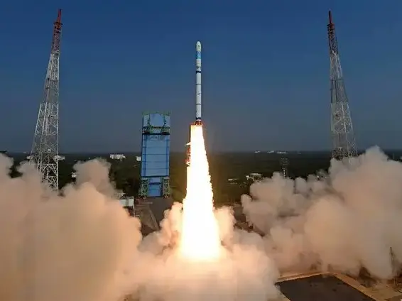
Representative image of an Indian SSLV rocket carrying a small satellite to space) Photograph: (Pic courtesy: ISRO)
The selection of this private grouping is based on a multi-stage evaluation process that began with 20 industries forming nine consortia.
The Indian Government agency IN-SPACE, responsible for promoting and supporting private space companies, announced that it has authorised a private consortium to design, build, launch, and operate a constellation of 12 Earth-imaging satellites. This is the first time in India that a group of private firms would be building and operating a fleet of multi-purpose satellites, a task which so far has been done only by the Government-run space agency ISRO.
According to IN-SPACE, the private grouping led by PixxelSpace India emerged as the successful bidder, and the consortium would invest more than ₹1,200crore(approx $137mn) over the next five years to launch the dozen-strong satellite fleet in a phased manner.
The selection of this private grouping is based on a multi-stage evaluation process that began with 20 industries forming nine consortia.
The dozen-strong satellite fleet that is meant to be placed in a near-Earth orbit (between 500-2000km above the surface) would have diverse Earth-imaging capabilities. They will be equipped with the following imaging capabilities: panchromatic(black-and-white imagery for mapping), multispectral(imagery using different color-filters to study land, soil, water, hyperspectral(high-precision imagery to identify crop type, map minerals, detect chrmical/biological activity) and microwave SAR(all-weather, day and night imagery using radar waves).
According to IN-SPACE, this constellation will deliver Analysis Ready Data (ARD) and Value-Added Services (VAS) for applications in climate change monitoring, disaster management, agriculture, infrastructure, marine surveillance, national security, and urban planning, while also catering to the global demand for high-quality geospatial intelligence.
While IN-SPACE said that the high-resolution indigenous satellite data would significantly reduce India’s reliance on foreign sources and ensure data sovereignty, it was not specified whether there are assured Indian customers(Government or private) who would be purchasing this data. Rajeev Jyoti, Director, Technical Directorate, IN-SPACE, said, “All three shortlisted bidders submitted excellent technical and business plans".
Trending Stories
)
)
)
)
)
)
)
)
&im=FitAndFill=(700,400))
)
)
&im=FitAndFill=(700,400))
)
)
)
)
)
)
)
)
)
)
)
)
)
)
)
)
)
)
)
)
&im=FitAndFill=(700,400))
)
)
)
)
)
Dr. Pawan Goenka, Chairman, IN-SPACE, said, “This initiative signals the coming of age of India’s private space industry. It demonstrates the capability and confidence of Indian companies to lead large-scale, technologically advanced, and commercially viable space missions that serve both national and global markets. The Earth Observation-Public Private Partnership model fosters an ecosystem where public and private capabilities reinforce each other to drive growth, innovation, and self-reliance.”
Under the Public Private Partnership framework, the Government of India will provide strategic, technical, and policy support, while the PixxelSpace India-led consortium will own and operate the EO system, including satellite manufacturing, launches from Indian soil, ground infrastructure, and commercialisation of data services, it was added.

