Tehran toll booth: Iran announces 'alternative routes' in Hormuz; Why is it forcing oil tankers into IRGC-controlled waters?

&imwidth=600&imheight=450&format=webp&quality=medium "Tehran toll booth: Iran announces 'alternative routes' in Hormuz; Why is it forcing oil tankers into IRGC-controlled waters?")
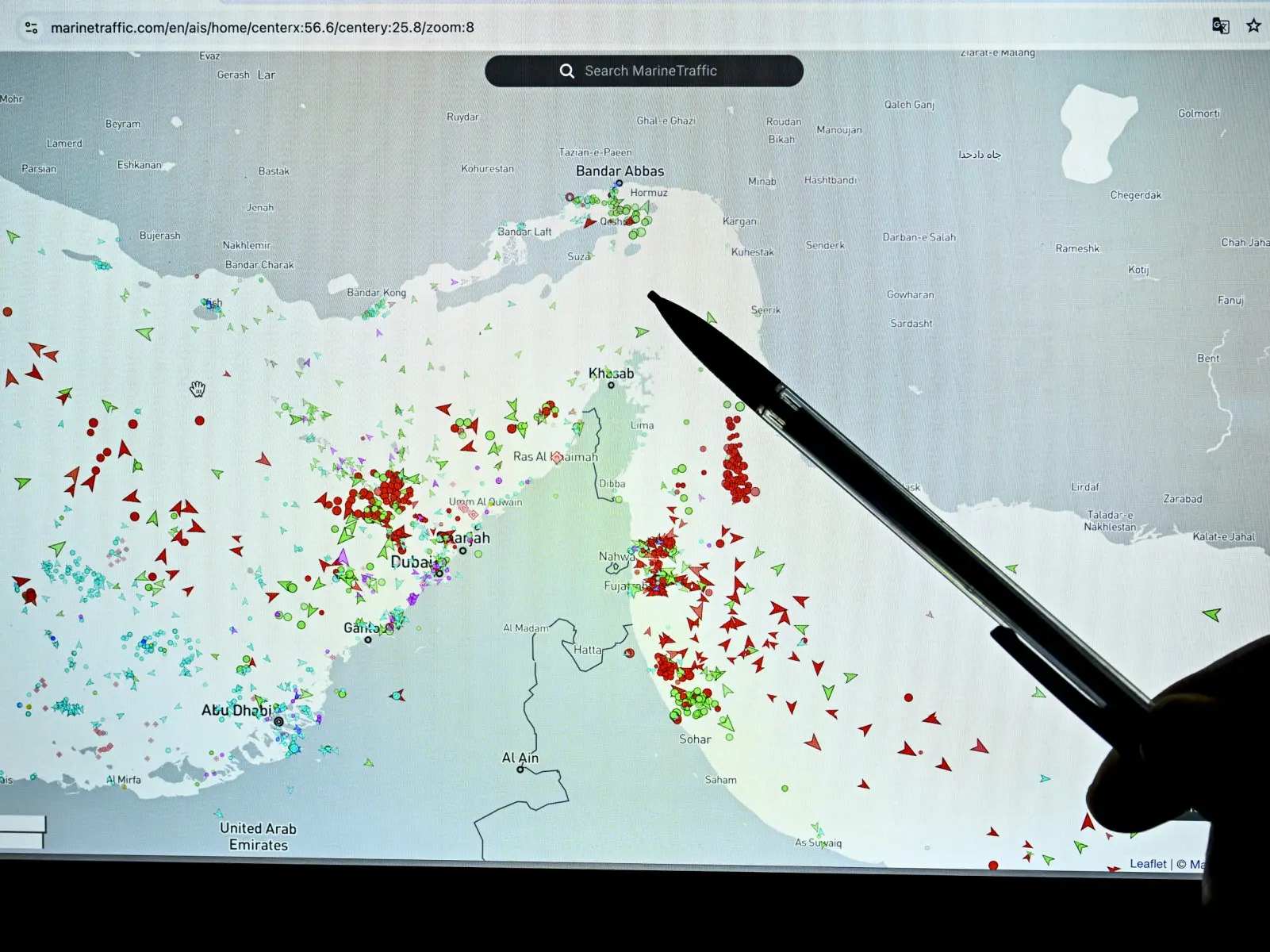
A person points at a page on the Marinetraffic website that shows commercial traffic on the edge of the Strait of Hormuz on March 4. Photograph: (AFP)
Why is Iran redirecting ships even after reopening the Strait of Hormuz? Tehran has flagged risks of sea mines and redrawn routes, pushing vessels into tightly controlled corridors under its watch. All you need to know about the alternative routes shared by the IRGC.
Iran on Thursday (Apr 9) announced alternative routes for ships travelling through the Strait of Hormuz. Flagging the risk of sea mines in the main zone of the vital waterway, Iran's Revolutionary Guards, in a statement, advised ships to "comply with the principles of maritime safety" and opt for alternative routes. This comes a day after a two-week ceasefire was announced between the United States and Iran. The fragile includes the reopening of the Strait of Hormuz, Iranian Foreign Minister Seyed Abbas Araghchi announced in a post on X on Wednesday (Apr 8). The closure of the chokepoint since the Iran war began on February 28 has sent oil prices surging past $100 a barrel, and even pushed several Asian nations toward fuel rationing.
Also read | Oil lifeline back? Tehran reopens Strait of Hormuz for 2 weeks as US-Iran agree to 11th-hour truce
Why is there a need for alternative routes in the Strait of Hormuz?
According to the statement published in local media, the Iran Ports and Maritime Organization has redrawn the traffic separation in the Strait to "avoid possible collisions with naval mines." Notably, reports suggest that Iran has laid up to a dozen mines in the waterway this month. However, the claims remain unverified.
What alternative routes did Iran propose?
According to Maritime Executive, the new scheme by the Iranian maritime authority appears to be designed to steer inbound traffic between the islands of Qeshm and Larak, along the so‑called "Tehran toll booth" corridor controlled by the IRGC. Meanwhile, the outbound traffic lane now runs just south of Larak, remaining within Iranian territorial waters and keeping vessels within easy range of IRGC escorts, boardings, and identity verification checks.
Trending Stories
&imwidth=280&imheight=210&format=webp&quality=medium)
&im=FitAndFill=(700,400)&imwidth=280&imheight=210&format=webp&quality=medium)
&imwidth=280&imheight=210&format=webp&quality=medium)
&imwidth=280&imheight=210&format=webp&quality=medium)
&imwidth=280&imheight=210&format=webp&quality=medium)
&imwidth=280&imheight=210&format=webp&quality=medium)
&imwidth=280&imheight=210&format=webp&quality=medium)
&imwidth=280&imheight=210&format=webp&quality=medium)
&imwidth=280&imheight=210&format=webp&quality=medium)
&imwidth=280&imheight=210&format=webp&quality=medium)
&imwidth=280&imheight=210&format=webp&quality=medium)
&imwidth=280&imheight=210&format=webp&quality=medium)
&imwidth=280&imheight=210&format=webp&quality=medium)
&imwidth=280&imheight=210&format=webp&quality=medium)
&im=FitAndFill=(700,400)&imwidth=280&imheight=210&format=webp&quality=medium)
&imwidth=280&imheight=210&format=webp&quality=medium)
&imwidth=280&imheight=210&format=webp&quality=medium)
&imwidth=280&imheight=210&format=webp&quality=medium)
&imwidth=280&imheight=210&format=webp&quality=medium)
&imwidth=280&imheight=210&format=webp&quality=medium)
&imwidth=280&imheight=210&format=webp&quality=medium)
&imwidth=280&imheight=210&format=webp&quality=medium)
&imwidth=280&imheight=210&format=webp&quality=medium)
&im=FitAndFill=(700,400)&imwidth=280&imheight=210&format=webp&quality=medium)
&imwidth=280&imheight=210&format=webp&quality=medium)
&imwidth=280&imheight=210&format=webp&quality=medium)
&imwidth=280&imheight=210&format=webp&quality=medium)
&imwidth=280&imheight=210&format=webp&quality=medium)
&imwidth=280&imheight=210&format=webp&quality=medium)
&imwidth=280&imheight=210&format=webp&quality=medium)
&imwidth=280&imheight=210&format=webp&quality=medium)
&imwidth=280&imheight=210&format=webp&quality=medium)
&imwidth=280&imheight=210&format=webp&quality=medium)
&imwidth=280&imheight=210&format=webp&quality=medium)
&imwidth=280&imheight=210&format=webp&quality=medium)
&imwidth=280&imheight=210&format=webp&quality=medium)
Also read | Iran’s 10-point plan EXPLAINED: Compensation, sanctions, Hormuz and more, here's what Tehran wants after 2-week ceasefire deal
The chart also introduces a designated "danger zone" marked as "transit prohibited" in the area that previously supported deep‑sea navigation. The coordinates of this zone encompass the IMO‑approved traffic separation scheme (TSS) located off the northern tip of the Musandam Peninsula.
In addition, the warning area appears to extend over the newly established, Omani‑administered shipping lane at the far southern edge of the strait, seemingly contradicting the widely discussed Omani‑Iranian agreement governing transits through Oman’s territorial waters.
Disclaimer: WION takes utmost care to accurately and responsibly report ongoing conflicts in West Asia involving Israel, Iran, US, Gulf nations and non-state actors like Hezbollah, Hamas, Houthis, Islamic State, and others. Claims and counterclaims, disinformation and misinformation are being made online and offline. Given this context, WION cannot independently verify the authenticity of all statements, social media posts, photos and videos.