How Beijing’s satellites are winning the Iran war

&imwidth=600&imheight=450&format=webp&quality=medium "How Beijing’s satellites are winning the Iran war")
Iran flag, China flag Photograph: (FreePik)
Ships from China carrying sodium perchlorate, a chemical used in missile fuel, are believed to have reached Iran. US intelligence has warned that China may also be preparing to supply shoulder-fired rockets, which can target helicopters and low-flying aircraft.
Since Operation Epic Fury began on February 28, China has taken a very careful and limited role in openly supporting Iran. On March 2, China’s foreign ministry said that the U.S. and Israeli strikes break international law, showing political support without direct involvement.
There are also signs of quiet, indirect help. Ships from China carrying sodium perchlorate, a chemical used in missile fuel, are believed to have reached Iran. U.S. intelligence has warned that China may also be preparing to supply shoulder-fired rockets, which can target helicopters and low-flying aircraft.
However, China has not provided major direct support like money or open military help. Instead, its biggest role is coming from an unexpected domain—space.
Also read | IRGC gunboat fires on container ship near Oman: Heavy damage reported amid Strait of Hormuz standoff
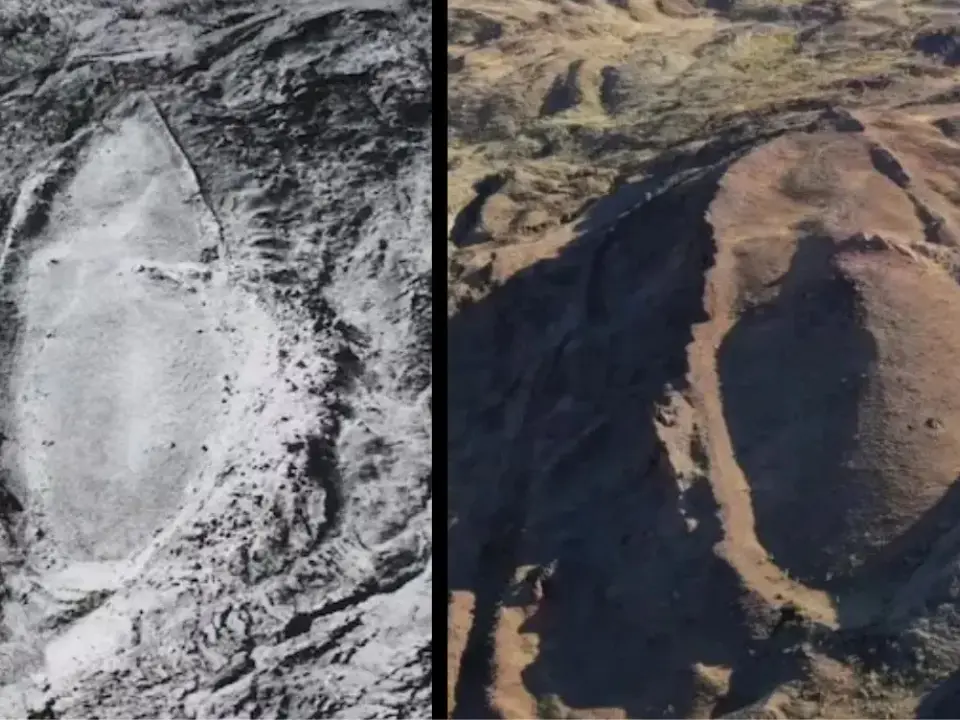
As highlighted by The Economist, social media is now flooded with satellite images of the Middle East captured by Chinese satellites and shared by Chinese companies. At the same time, American firms have restricted access to their satellite data due to pressure from the Trump administration. This has cut off journalists, researchers, and analysts from getting important open information.
This restriction has now become even tighter. Planet Labs, a major U.S. satellite company, moved from a 14-day delay to an indefinite blackout on April 5, 2026. This means users no longer know when or if they will get fresh images. Because of this, the global OSINT (Open Source Intelligence) community is now heavily dependent on Chinese and European satellite data.
Trending Stories
)
)
)
)
)
)
)
)
)
)
)
)
)
)
)
)
)
)
)
)
)
)
)
)
)
)
)
)
)
)
)
)
)
)
&im=FitAndFill=(700,400))
)
)
)
)
One major trigger for this shift was the Minab incident on February 28, where a Tomahawk missile strike hit a school in Iran. Chinese satellite images were later used by international journalists to prove U.S. involvement, creating global pressure. This is widely seen as one of the reasons behind the strong American reaction against what some call “space transparency.”
Because of these developments, Chinese satellite images are becoming more important than ever. They show how much China has improved its Earth-observation technology, meaning satellites that capture detailed images of Earth. This also shows that the West no longer has full control over high-quality space imagery.
For analysts, this creates a mixed situation. Chinese images are useful, but they also raise serious concerns about control and credibility.
The ongoing war has become a major opportunity for Chinese satellite companies to expand globally. As noted by The Economist, expert Bill Greer says that U.S. restrictions are unintentionally helping competitors like China, because American firms are limiting themselves while others fill the gap.
There is also growing evidence of direct links between Chinese satellite companies and Iran. Leaked documents from April 15 revealed that Iran’s Revolutionary Guards acquired a Chinese satellite called TEE-01B, built by Earth Eye Co. This satellite was reportedly used to help target Prince Sultan Air Base on March 14, making it a major “smoking gun” showing real operational support.
China’s strength lies in its rapidly expanding satellite network. In 2025 alone, it launched over 120 Earth-observation satellites, taking its total to more than 640 satellites, second only to the United States. These satellites use cameras, radar, and radio signals to monitor Earth.
In China, the difference between private companies and the government is very small, meaning many firms are closely linked to the state. For example, the Jilin-1 network, with over 100 satellites, has ties to the military and can capture images of any place on Earth every 10 minutes.
In terms of technology, China and the U.S. are now almost equal. China’s Superview Neo-1 satellite can produce images as sharp as top American systems. In some areas, like how frequently satellites revisit the same location, China may even be ahead because it has more satellites.
China is also advancing in processing data directly in space, which means analysing images before sending them to Earth. Experts believe this advantage will grow further, as China leads in remote sensing technologies—tools used to study Earth from space.
Another key benefit is that Chinese firms are not restricted by Western “shutter control” rules, which limit what satellite images can be shared. A Dubai-based company said Chinese partners provide faster and easier access to data, without delays from strict export rules.
However, Chinese companies also have their own limitations, as they operate under government control. A former U.S. intelligence officer said they only act within what the Communist Party allows.
In some cases, Chinese satellite images have actually exposed damage to U.S. military equipment and Gulf energy sites, which governments might have preferred to keep hidden. This has increased transparency in certain situations.
Companies like MizarVision are using artificial intelligence (AI) to improve satellite images. AI helps sharpen blurry pictures, identify objects like aircraft, and track movements over time. Even if images are unclear, AI helps analysts understand what is happening.
At the same time, AI is not always accurate. Some labels may be wrong, but feedback helps improve the system. Experts can correct mistakes, and the AI learns to become more precise.
This is not the first time Chinese satellite firms have supported groups opposing the U.S. In the past, CGST shared images with the Wagner Group and Houthi rebels, which could help target military assets. Even after sanctions, Chinese companies like Spacety continue to grow and attract funding.
China is also moving ahead in satellite video technology. Networks like Jilin-1 and Zhuhai-1 can record videos from space, while only one American company, Planet, has similar capability. Jilin-1 even uses laser communication to send videos directly to Earth.
Still, some experts remain cautious. They worry about military links, and say Chinese firms do not always respond to data requests.
Earlier, many believed that more satellites would bring greater global transparency. But today, the situation is different. As more countries build their own systems, most are focused on defence and intelligence use, not public sharing.
In simple terms, the world is moving towards a reality where more countries are watching each other, but less information is openly available to everyone.
