
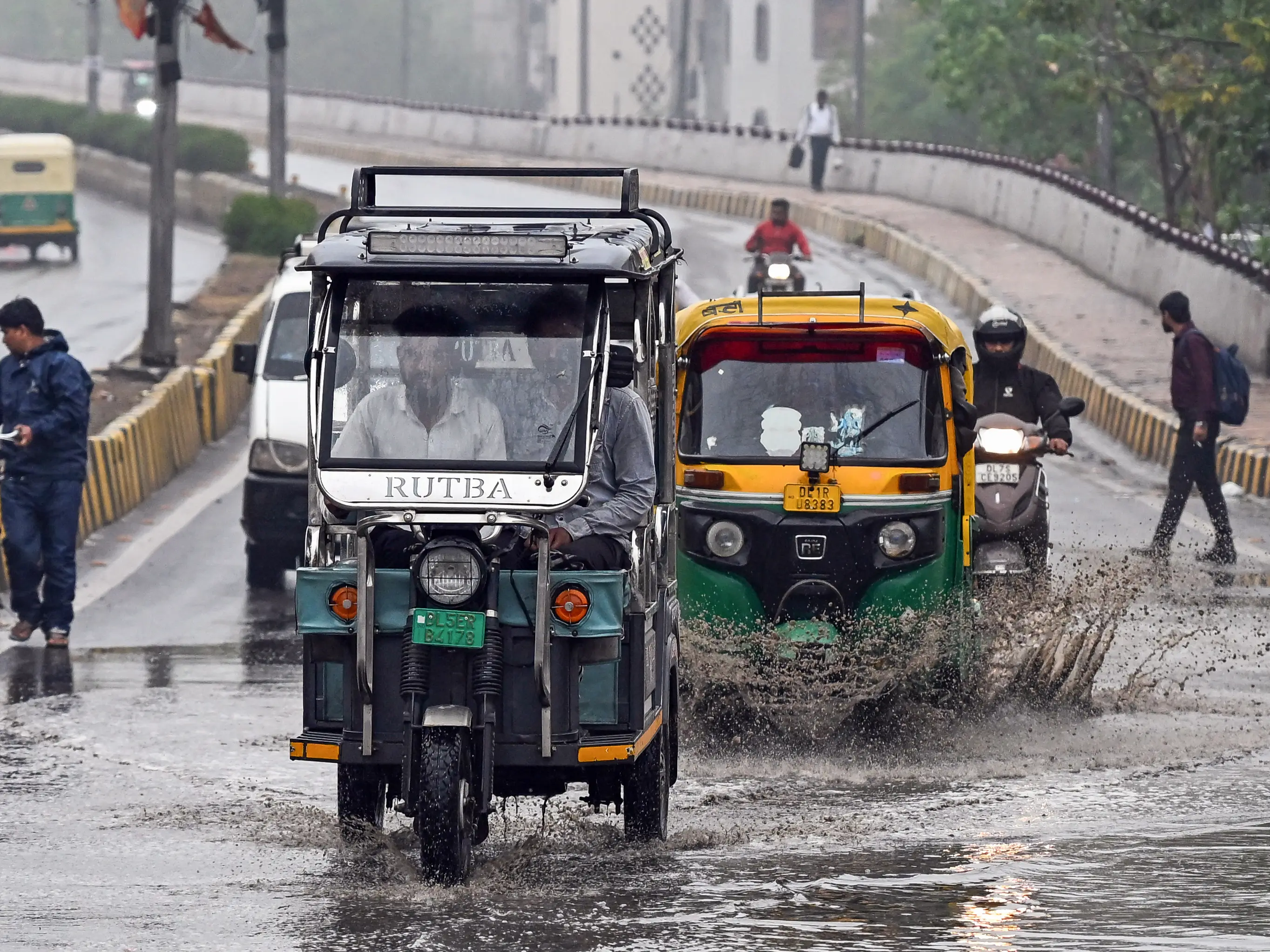
&imwidth=800&imheight=600&format=webp&quality=medium "IMD issues nationwide rain alert, warns of thunderstorms, hailstorms & gusty winds across multiple regions")
The India Meteorological Department (IMD) issued a nationwide weather alert on Saturday, predicting widespread rainfall along with thunderstorms, lightning, and gusty winds across multiple regions in the next few days. In its latest weather update, the agency reported increased weather activity across eastern, central, and northeastern parts of the country, warnings of heavy rainfall, thundersqualls, and possible hailstorms.
Sub-Himalayan West Bengal and Sikkim are expected to receive widespread rainfall from March 21 to 24, with isolated areas likely to see heavy to very heavy rainfall on March 21. Parts of Gangetic West Bengal may experience thundersqualls with wind speeds reaching up to 80 kmph, while Odisha could see gusty winds up to 70 kmph along with chances of hailstorms, according to the IMD.
Northeastern region & Northwest are likely to see wet weather

In the northeastern region, states like Manipur, Mizoram, and Tripura are likely to witness fairly widespread rainfall accompanied by thunderstorms and gusty winds. Meanwhile, Assam, Meghalaya, and Arunachal Pradesh may receive isolated heavy rainfall on March 24. In eastern and central India, including Bihar, Jharkhand, Chhattisgarh, and Madhya Pradesh, scattered rainfall along with strong winds is expected over the coming days.
Northwest India is also expected to see fresh wet weather, with light to moderate rain and snowfall predicted in Himachal Pradesh and Uttarakhand on March 23. East Uttar Pradesh may experience fairly widespread rainfall with winds reaching up to 40 kmph.
IMD Scientist Akhil Shrivastava told news agency ANI, "A large-scale thunderstorm activity is currently being witnessed across India. In Delhi, rainfall activity occurred yesterday, resulting in a significant drop in maximum temperatures. Our forecast indicates that similar intermittent rainfall activity is likely to occur during the evening hours today. However, this activity is expected to subside in Delhi starting tomorrow, with the probability of rain decreasing from tomorrow onwards."
Trending Stories
&im=FitAndFill=(700,400))
National Handloom Day 2026: From Alia Bhatt to Samantha Ruth Prabhu; Actresses who celebrated India's textile heritage as brides
)
The Royals enter the Doctor Who universe: King Charles and Queen Camilla beam into Commonwealth Games in TARDIS
)
Unitree Robotics targets $9 billion valuation in landmark IPO backed by DeepSeek and Tencent
)
India names 27 sites in Arunachal Pradesh
)
Bharat Bhhagya Viddhaata OTT: When will Kangana Ranaut's film stream online?
&im=FitAndFill=(700,400))
How many soldiers operate one S-400 battery?
)
Shakib Al Hasan ready to return to Bangladesh—under one condition
)
‘Fake news’: MEA rejects report claiming India sought defence pact with Israel after Pakistan, Saudi Arabia, Turkey deal
)
Rockstar to unveil GTA 6 extended look ahead of November launch
)
Russia forms Ukrainian Volunteer Spetsnaz Brigade to fight Ukraine
)
Drug-resistant fungus that hides in hair and enters bloodstream reported in 23 US states
)
Technology transfer deal boosts India's defence manufacturing ambitions
)
Border row erupts in Europe after Ceuta crossings, Spain imposes border controls on Italy
)
Morale plummets on USS Abraham Lincoln: Are US sailors reaching a breaking point? | GRAVITAS
)
'Security can't be bought with Pakistan, Turkey deal': Iran tells Saudi Arabia
)
Baba Vanga's 2026 prophecy: 2 predictions 'already came true', 3 terrifying ones remain. Details inside
)
Colombia’s new president Abelardo de la Espriella vows to ‘defeat narco-terrorists’, signals hardline shift
&im=FitAndFill=(700,400))
New Friday OTT releases (August 7, 2026): Operation Safed Sagar, Vadhandhi, Main Vaapis Aaunga- 6 movies and TV shows on Netflix, Prime Video and more
)
Squadron Leader Bhawana Kanth scripts history as Indian Air Force gets its first woman ‘Top Gun’ pilot
)
RSS says Gen Z protests reflect genuine distress
)
Trump says Iranian school bombing photos could be AI-generated - 'I don’t think...'
)
IAF officer held for sharing sensitive information in 'honey trap' case, booked under Official Secrets Act
)
Stray Kids under scrutiny? Fans react to Grammy submission silence after BTS boycott
&im=FitAndFill=(700,400))
Why the Su-30MKI doesn't need external fuel tanks to fly vast distances
)
Jugal Hansraj reunites with Shekhar Kapur after 40 years for Masoom: The Next Generation
)
New speed limits, automatic challans: Big traffic change coming to Delhi-Meerut Expressway. All you need to know
)
India officially names 27 places in Arunachal to counter China's renaming claims
)
Trump calls White House ballroom ruling a 'national disgrace' as court says Congress approval needed
)
US sanctions Iran’s crypto network after Strait of Hormuz attacks, offers $15m bounty for intel on IRGC finance
&im=FitAndFill=(700,400))
Why the Su-30MKI is one of the heaviest fighters ever built
)
Uttarakhand young innovator builds India's own flying vehicle, conducts first test flight: WATCH
)
Chilling video shows students take cover as teen opens fire at Thai school
)
Reese Witherspoon's father hospitalised after poolside incident in Nashville: Report
"While conditions are mainly cloudy today, they are expected to become partly cloudy tomorrow. Compared to yesterday, a slight further decline of about 2-3°C may be observed in maximum temperatures today. Nevertheless, temperatures are expected to begin rising again after tomorrow," he said.
Shrivastava further noted that an 'Orange Alert' had been issued for regions including eastern Uttar Pradesh, Bihar, Jharkhand, Chhattisgarh, Odisha, and parts of West Bengal due to expected thunderstorms, gusty winds, and possible hailstorms. "Wind speeds in eastern India may reach 60 to 70 kmph, posing potential risks," he said.
Meanwhile, southern states and parts of Maharashtra are also likely to experience scattered rainfall; however, hot and humid conditions might prevail over coastal Karnataka, Goa and Kerala.

