Hurricane Polo becomes 'strongest' Cat 5 in Pacific overnight. What you need to know

&imwidth=600&imheight=450&format=webp&quality=medium "Hurricane Polo becomes 'strongest' Cat 5 in Pacific overnight. What you need to know")
Hurricane Polo intensified so quickly on Tuesday that scientists are in shock. Photograph: (AFP)
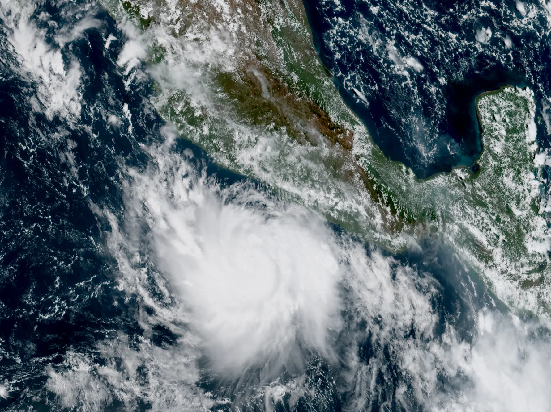
Hurricane Polo has shocked meteorologists by turning into a Category 5 storm within 24 hours of forming. It is now the most powerful storm recorded in the eastern Pacific. Its central pressure below 900 has only been seen in nine hurricanes in 76 years.
Hurricane Polo has quickly intensified to become the strongest storm recorded in the eastern Pacific Ocean in decades. It exploded into an "extremely dangerous" Category 5 storm on Tuesday, less than 24 hours after it became a hurricane. The National Hurricane Center said it has maximum sustained winds of 265 kmph. It is expected to brush past Mexico's southwestern coast as a Category 5 storm and is currently 338 kilometres south of Zihuatanejo.
Satellite images show extreme lightning around its eye, which is nearly stationary, with wind gusts reaching up to 356 kmph in the eyewall. The Category 5 storm is barely moving, which means it will continue to pull huge amounts of water. It intensified almost overnight, at the fastest rate ever observed in the Eastern Pacific.
Path of Hurricane Polo
The storm's exact path remains unknown. Computer models show that it could either stall or loop, and even travel across northwestern Mexico. It could also bring dangerous conditions to the Baja Peninsula and western Mexico early next week. Remnant moisture from the system will push upwards towards the US in the next 10 days.
Mexican President Claudia Sheinbaum said Polo will not touch land, according to forecasts. However, people are staying away from beaches amid choppy seas. Several regions also suspended classes on Tuesday. Ports were shut down in the states of Guerrero and Michoacán, where 3 to 6 inches of rain can be expected. Heavy rains can trigger flash floods and mudslides. Fishermen have also been told to remain alert.
How did Hurricane Polo intensify so quickly?
Trending Stories
)
)
)
)
)
)
)
)
)
)
)
)
)
)
)
)
)
)
)
)
)
&im=FitAndFill=(700,400))
)
)
)
)
)
)
&im=FitAndFill=(700,400))
)
)
)
)
)
)
)
)
)
The rapid intensification is clearly the result of El Niño, the weather phenomenon that brought droughts in Mexico and Central America. Surface ocean temperatures were 3.05 degrees Celsius above average in the Pacific on September 19. This creates the perfect conditions for hurricanes and typhoons. Meanwhile, the Atlantic has been without a major hurricane this season, the exact opposite effect of El Niño in the region.
Hurricane Polo has already set and broken several records
The hurricane is the strongest in the eastern Pacific in decades. National Hurricane Center data shows that only a few storms compare to Polo's speeds, one of which was Hurricane Patricia that formed in 2015 with wind speeds of 346 kmph. The last storm to intensify this quickly was Hurricane Otis in 2023, which brought widespread destruction in Acapulco, Mexico.
With wind speeds of 265 kmph, Polo is tied with Hurricane Rick from 2009 for the third-highest winds ever recorded in the Pacific. It also has the fourth-highest wind speed of any hurricane worldwide.
Hurricane Polo has also recorded the second-lowest pressure ever observed in the Pacific, with Hurricane Patricia ahead of it. The central pressure fell to 892 millibars, with only nine hurricanes of 1,088 recording pressures below 900 millibars since 1950. Hurricane Polo is the third Category 5 hurricane in the Eastern and Central Pacific this season, with Genevieve and Lowell being the other two.

