Greenland lost 600 billion tonnes of ice last summer alone

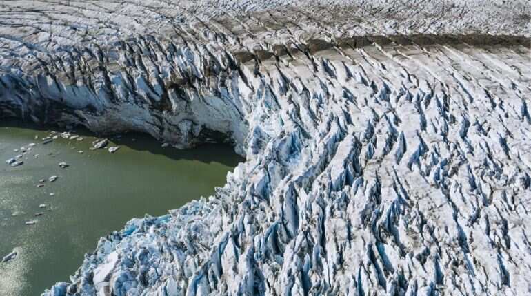
An aerial photo taken on August 17, 2019 shows a view of the Apusiajik glacier
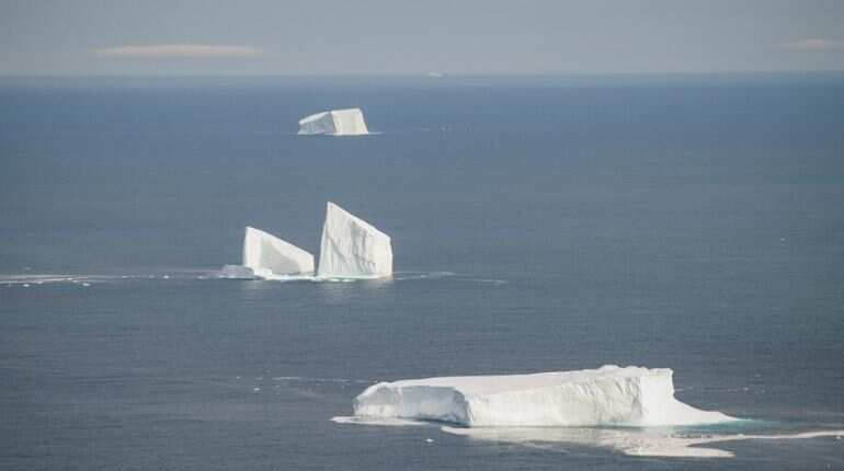
Almost 600 billion tonnes of ice was lost from the Greenland area during the summer of 2019 alone. In turn, this raised the global sea levels by almost 0.1 inches within a span of just two months.
These findings were published as part of a study in the Geophysical Research Letters.
This also coincided with the Arctic experiencing its hottest year ever. The ice has continued to melt from both the Amundsen Sea Embayment and the Antarctic Peninsula, reported the Daily Mail.

However snowfall in Queen Maud Land broughtrelief in the region.
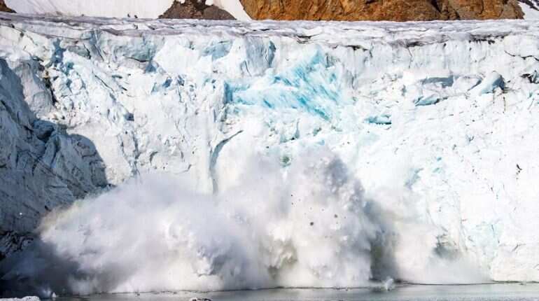
NASA and the German Aerospace Centre noticed changes in the ice volumes during two twin gravity measure satellite operations.
)
Trump-Xi Summit: Trade, Taiwan and the red lines shaping US-China talks | Race To Power
)
US citizen injured in Illinois after ICE agents mistook him for fugitive, hospitalised
)
US judge questions Trump’s decision to ban CNN, MS NOW and Politico from White House
)
Afghan woman cyclist who disguised herself as a boy to escape Taliban, wins Asian Games medal
)
'There will be elections': Venezuela's interim leader Delcy Rodriguez makes big announcement at UN
)
IIT Bombay CCTV footage emerges: Sahil Wakode seen looking at phone in examination hall
)
Cyclone Arnab: Landfall expected before midnight tomorrow as IMD issues orange alerts across six states
)
9 killed, several injured as tourist bus catches fire on Yamuna Expressway
)
NBA player Steven Adams shares hilarious GTA VI theory
)
WION Iconic Tourism Summit 2026: Union Minister Shekhawat on 'experiential travel', peace diplomacy
)
ICC plans T20I expansion and fewer ODIs in 2027–2031 FTP cycle: Report
)
'AI got into my speech': Prince Harry jokes after teleprompter failure at event in New York
)
Scientists detect first radio signals directly from faraway planet
)
China to test supersonic jet that moves at Mach 2, double the speed of sound
)
WION Iconic Tourism Summit: 'Hanuman Ansh' Director on blockbuster success
)
Open AI, Anthropic CEO urges caution over rapid AI development at UN Security Council, call for 'extreme care'
)
Bomb scare in New York amid UNGA: Suspicious suitcase found near UN headquarters
)
Hours before Xi-Trump meeting, US announces visa curbs targeting birth tourism: What is it?
)
'Partners rather than rivals': Xi Jinping's first message after landing in US for Trump summit
)
WION Iconic Tourism Summit: Is India's travel boom outrunning its airports, airlines and hotels?
)
WION Iconic Tourism Summit and Awards 2026: Key voices to discuss India’s tourism future
&im=FitAndFill=(700,400))
New OTT releases this week (September 21-27, 2026): Shaque: Trust No One, Hunkkaar, Don’t Be Shy- 5 new titles coming to Netflix, Prime Video and more
)
WATCH | China President Xi Jinping lands in US as Trump greets him ahead of high-stakes summit
)
Australian PM Anthony Albanese calls OpenAI AI incident 'unacceptable' after restricted data access
)
'What kind of confession is this?': Pakistan PM Shehbaz Sharif’s 'terrorists would be roaming New York' remark goes viral, raises alarm online. Watch
)
WION Iconic Tourism Summit: How local tourism MSMEs must upskill for AI integration
)
Eight USS Abraham Lincoln sailors attempted suicide, Acting Navy Secretary says
)
Pilot recreates Mona Lisa in sky over Oklahoma and Arkansas in four-hour flight: VIDEO
)
Elephants hide behind trees, stage surprise attack on poachers targeting rhinos in South Africa
)
'Putin is patient zero': Zelensky slams Russian president at UNGA, accuses him of using fighters from 47 countries
&im=FitAndFill=(700,400))
National Film Awards 2026: Kartik Aaryan, Mammootty, Yami Gautam, Randeep Hooda and other key winners
)
El Niño 2026 heats up to become strongest in 1,000 years
)
Israeli envoy to US Yechiel Leiter’s son critically injured in West Bank ramming attack
&im=FitAndFill=(700,400))
Trump welcomes Xi Jinping in rare airport gesture: Photos from Chinese President's arrival in US
)
Xi-Trump meeting: China’s human rights red line and past protests explained
“We knew this past summer had been particularly warm in Greenland, melting every corner of the ice sheet, but the numbers are enormous”, said Isabella Velicogna of the University of California, Irvine, one of the authors of the paper.
Last summer, Greenland lost ice twice as much as it did every year in the period between 2002-2019. During this period, the country lost 4,550 billion tonnes.
According to Velicogna, the loss of mass in Antarctica continues on, which could cause further rise in sea levels. However, a mass gain has also been observed in East Antarctica, triggered by snowfall.
The study, undertaken by Professor Velicogna and colleagues collated data from NASA and Germany Aerospace Centre’s late Gravity Recovery and Climate Experiment (GRACE) satellites.
The GRACE satellites operate as a pair, and have successfully been able to measure the changes in Earth’s gravity between March 2002 and October 2017.
The satellites have been able to operate for 15 years longer than expected.
Besides giving insight into the loss suffered by polar regions, the data from the satellites have enabled researchers and scientists to map out and measure the water reserves available on Earth. These include groundwater and polar ice.
Additionally, the data has also helped in understanding the global rise in sea levels.
The GRACE-FO craft, successor to the GRACE operation was launched in May 2018 and uses an experimental laser device to understand and compare the recordings of two satellites.
This has helped Velicogna and their team in gathering accurate data.