UN votes to ‘correct the map’ as India backs fairer world view

&imwidth=600&imheight=450&format=webp&quality=medium "UN votes to ‘correct the map’ as India backs fairer world view")
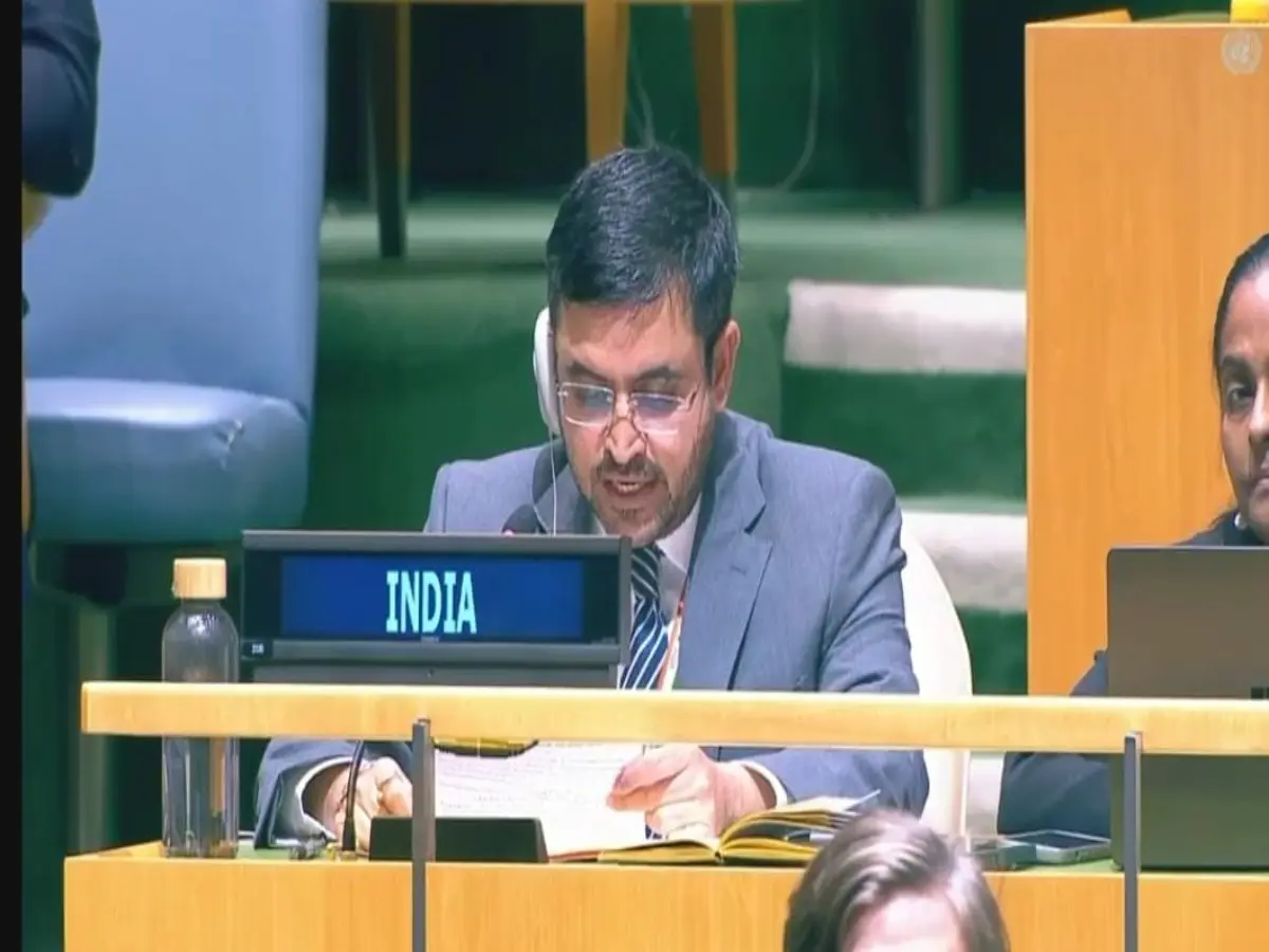
Indian Diplomat Raghoo Puri addresses UNGA over UN's "correct the map" resolution
India voted in favour as Indian Diplomat Raghoo Puri told the Assembly the delegation welcomed the aim of more accurate, representative maps.
The United Nations General Assembly has voted overwhelmingly to encourage a shift away from the familiar Mercator world map towards projections that show continents closer to their true size. The non-binding “Correct the Map” resolution, sponsored by Togo and backed by African Union members, passed 164-1 on Friday, with six abstentions. The United States cast the only no vote. For more than four centuries the Mercator projection has been the default classroom and newsroom map. It keeps compass bearings straight, useful for sailors, but stretches land near the poles. Greenland can look as large as Africa. Africa is in fact about 14 times bigger.
India voted in favour. Indian Diplomat Raghoo Puri told the Assembly the delegation welcomed the aim of more accurate, representative maps. “Maps play an important role in how societies understand geography and the relative scale of the world around us,” he said. But New Delhi's backing came with a caveat. The resolution, Puri argued, should be read as support for equal-area projections in general , maps that keep the relative size of landmasses honest, not as an endorsement of the 2018 Equal Earth projection or any single design.
“Equal area projections are particularly relevant because they preserve the relative sizes or areas of continental and territorial landmasses,” he said. “This can help address distortions in perceived landmass size.” Different jobs need different maps, he added. No one projection fits every purpose. The text should stay “technological and methodological neutral,” leaving countries, schools and cartographers free to choose.
India’s position, he pointed, was limited to “the principle of encouraging equal area approaches, where the objective is to preserve the relative sizes of continental landmasses.” That, he said, met the resolution’s goal without favouring one method. “India has therefore voted in favor of this resolution.”
The resolution does not ban Mercator. Navigators can still use it. It urges schools, media, governments and tech firms to prefer equal-area maps when size comparisons matter. France has already said it will drop Mercator in official materials. The African Union adopted Equal Earth earlier this year. Washington called the vote a distraction from peace and prosperity and linked it to a “radical ideological project.” Six countries, several in Eastern Europe, abstained.
Trending Stories
&im=FitAndFill=(700,400)&imwidth=280&imheight=210&format=webp&quality=medium)
&imwidth=280&imheight=210&format=webp&quality=medium)
&imwidth=280&imheight=210&format=webp&quality=medium)
&imwidth=280&imheight=210&format=webp&quality=medium)
&imwidth=280&imheight=210&format=webp&quality=medium)
&imwidth=280&imheight=210&format=webp&quality=medium)
&imwidth=280&imheight=210&format=webp&quality=medium)
&imwidth=280&imheight=210&format=webp&quality=medium)
&imwidth=280&imheight=210&format=webp&quality=medium)
&imwidth=280&imheight=210&format=webp&quality=medium)
&imwidth=280&imheight=210&format=webp&quality=medium)
&imwidth=280&imheight=210&format=webp&quality=medium)
&imwidth=280&imheight=210&format=webp&quality=medium)
&imwidth=280&imheight=210&format=webp&quality=medium)
&imwidth=280&imheight=210&format=webp&quality=medium)
&imwidth=280&imheight=210&format=webp&quality=medium)
&imwidth=280&imheight=210&format=webp&quality=medium)
&imwidth=280&imheight=210&format=webp&quality=medium)
&im=FitAndFill=(700,400)&imwidth=280&imheight=210&format=webp&quality=medium)
&imwidth=280&imheight=210&format=webp&quality=medium)
&imwidth=280&imheight=210&format=webp&quality=medium)
&imwidth=280&imheight=210&format=webp&quality=medium)
&imwidth=280&imheight=210&format=webp&quality=medium)
&im=FitAndFill=(700,400)&imwidth=280&imheight=210&format=webp&quality=medium)
&imwidth=280&imheight=210&format=webp&quality=medium)
&imwidth=280&imheight=210&format=webp&quality=medium)
&imwidth=280&imheight=210&format=webp&quality=medium)
&imwidth=280&imheight=210&format=webp&quality=medium)
&imwidth=280&imheight=210&format=webp&quality=medium)
&imwidth=280&imheight=210&format=webp&quality=medium)
&imwidth=280&imheight=210&format=webp&quality=medium)
&imwidth=280&imheight=210&format=webp&quality=medium)
&imwidth=280&imheight=210&format=webp&quality=medium)
&imwidth=280&imheight=210&format=webp&quality=medium)
Over time the vote is likely to filter into textbooks, news graphics and digital maps. Children in India and elsewhere may grow up seeing Africa as the vast continent it is.
