What is NISAR satellite and it's mission? India, US join hands for first time for Earth-observation project | Details inside

&imwidth=600&imheight=450&format=webp&quality=medium "What is NISAR satellite and it's mission? India, US join hands for first time for Earth-observation project | Details inside")
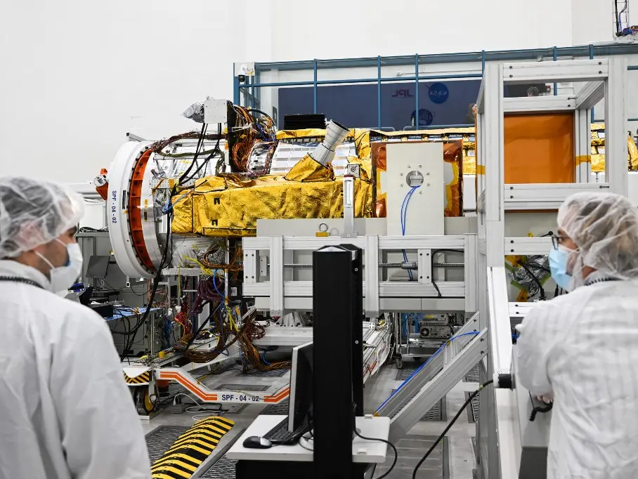
Workers prepare the NISAR satellite, a joint Earth-observing mission between NASA and the ISRO Photograph: (AFP)
NISAR mission will not only aim to improve how we understand and protect our Earth but it also stands as a strong example of how international collaboration between important organisations can advance science and technology.
India’s space agency ISRO (Indian Space Research Organisation) and America’s NASA (National Aeronautics and Space Administration) are joining hands together for a major satellite mission called NISAR (NASA-ISRO Synthetic Aperture Radar). This is the first Earth-observation satellite project in which two countries have agreed to work together. The ISRO confirmed the launch of the satellite for July 30 from the Satish Dhawan Space Centre in Sriharikota at 5:40 pm IST.
What is NISAR Satellite and its mission?
NISAR Satellite stands for NASA-ISRO Synthetic Aperture Radar. It is a powerful Earth-monitoring satellite that will provide detailed 3D images of our planet.
It is one of the most expensive space missions between India and the United States. The total cost of this mission is around $1.5 billion. What makes it special, is that it uses advanced radar technology to create detailed 3D maps of the Earths land and its ice surfaces. It is the first satellite in orbit with dual-frequency radar, combining NASA’s L-band and ISRO’s S-band radars.
Who will lead the launch?
India through ISRO will handle the launch of this satellite using its GSLV rocket. Engineers from both countries worked together to build key parts of the satellite, including a 12-meter-wide antenna and complex radar systems.
Trending Stories
&imwidth=280&imheight=210&format=webp&quality=medium)
&imwidth=280&imheight=210&format=webp&quality=medium)
&imwidth=280&imheight=210&format=webp&quality=medium)
&imwidth=280&imheight=210&format=webp&quality=medium)
&imwidth=280&imheight=210&format=webp&quality=medium)
&imwidth=280&imheight=210&format=webp&quality=medium)
&im=FitAndFill=(700,400)&imwidth=280&imheight=210&format=webp&quality=medium)
&imwidth=280&imheight=210&format=webp&quality=medium)
&imwidth=280&imheight=210&format=webp&quality=medium)
&imwidth=280&imheight=210&format=webp&quality=medium)
&imwidth=280&imheight=210&format=webp&quality=medium)
&imwidth=280&imheight=210&format=webp&quality=medium)
&imwidth=280&imheight=210&format=webp&quality=medium)
&imwidth=280&imheight=210&format=webp&quality=medium)
&imwidth=280&imheight=210&format=webp&quality=medium)
&im=FitAndFill=(700,400)&imwidth=280&imheight=210&format=webp&quality=medium)
&imwidth=280&imheight=210&format=webp&quality=medium)
&imwidth=280&imheight=210&format=webp&quality=medium)
&imwidth=280&imheight=210&format=webp&quality=medium)
&imwidth=280&imheight=210&format=webp&quality=medium)
&imwidth=280&imheight=210&format=webp&quality=medium)
&imwidth=280&imheight=210&format=webp&quality=medium)
&imwidth=280&imheight=210&format=webp&quality=medium)
&imwidth=280&imheight=210&format=webp&quality=medium)
&imwidth=280&imheight=210&format=webp&quality=medium)
&imwidth=280&imheight=210&format=webp&quality=medium)
&imwidth=280&imheight=210&format=webp&quality=medium)
&im=FitAndFill=(700,400)&imwidth=280&imheight=210&format=webp&quality=medium)
&imwidth=280&imheight=210&format=webp&quality=medium)
&imwidth=280&imheight=210&format=webp&quality=medium)
&imwidth=280&imheight=210&format=webp&quality=medium)
&imwidth=280&imheight=210&format=webp&quality=medium)
&imwidth=280&imheight=210&format=webp&quality=medium)
&imwidth=280&imheight=210&format=webp&quality=medium)
Specifications of NISAR satellite:
- The satellite will orbit the Earth every 12 days
- Tells us about the changes in forests and ecosystems
- Provide information regarding earth movements like earthquakes, landslides and volcanic activity
- Provides details about glacier melting and ice sheet movement
- Updates about the soil moisture and groundwater shifts
- Information about rising sea levels and urban growth
- Reliable in all weather conditions (can collect data through clouds and thick vegetation)
A symbol of partnership between India and United States
NISAR mission will not only aim to improve how we understand and protect our Earth, but it also stands as a strong example of how international collaboration between important organisations can advance science and technology and how it can provide benefits for the humanity.