NASA-ISRO NISAR satellite costs as much as ISRO's annual budget

&imwidth=600&imheight=450&format=webp&quality=medium "NASA-ISRO NISAR satellite costs as much as ISRO's annual budget")
NASA-ISRO NISAR satellite costs as much as ISRO's annual budget
The countdown for NASA-ISRO Synthetic Aperture Radar satellite launch has commenced, and the liftoff is scheduled on Wednesday (July 30). Here's all you need to know.
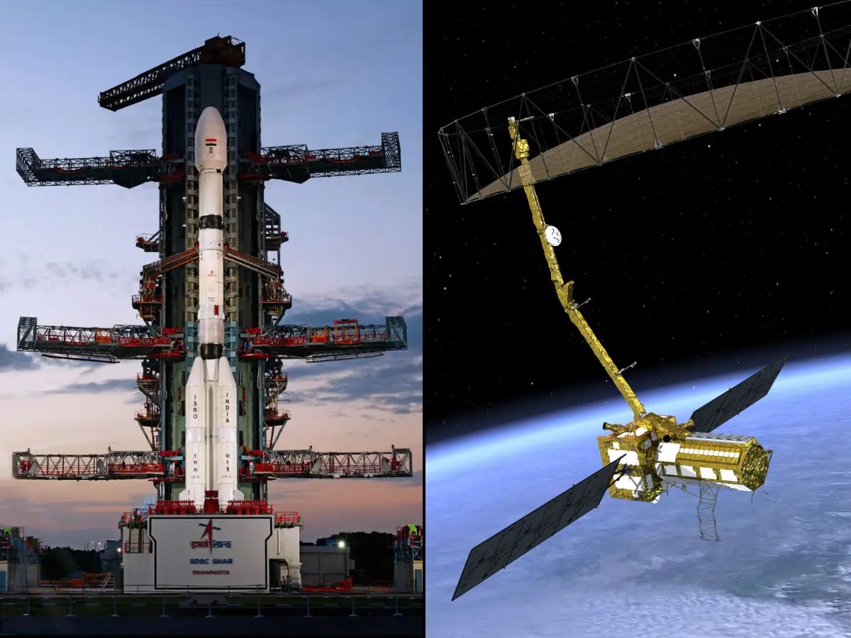
The countdown to the billion-dollar NASA-ISRO Synthetic Aperture Radar satellite launch commenced at 2:10 PM IST, Tuesday, July 29, at the Indian spaceport Satish Dhawan Space Centre(SDSC-SHAR). At 5:40 PM IST, Wednesday (July 30), the Indian GSLV-F16 rocket carrying the Earth-imaging satellite is scheduled to liftoff from the second launchpad of India's lone spaceport. The NISAR satellite weighs 2,400kg and sits atop the 52-meter-tall GSLV rocket, a three-staged launch vehicle that is powered by solid, liquid, and cryogenic fuels. The rocket is expected to place the satellite into orbit almost 19 minutes after liftoff, around 6 PM IST.
Costing well over a billion US dollars, the NISAR satellite is the first such collaborative mission between the Indian and American space agencies. While NASA has revealed that they've spent $1.2 billion on NISAR, ISRO has not officially revealed their financial contribution. Estimates say, ISRO is likely to have spent around $100 million. The vast difference in expenditure is said to be owing to the differences in accounting.
Notably, the estimated $1.3 billion (Rs.11,294 crore approx) cost of NISAR mission is almost as much as the annual budget of the Indian Space agency ISRO. In recent years, ISRO's annual budget has hovered between $1.3 billion and $1.5 billion. Therefore, it would be fair to say that there is a lot riding on ISRO's GSLV rocket- literally and figuratively.
How a radar-imaging satellite like NISAR works
Conventional Earth-imaging satellites click detailed colour photos of Earth, very similar to what a high-end camera does. In comparison, a radar-imaging satellite works in a totally different manner. Instead of giving an optics-based picture(like a photograph), radar satellites constantly beam radar waves onto the Earth. The features on Earth's surface, (buildings, trees, mountains, water bodies, roads, glaciers) reflect these radar waves back to the satellite. By collecting and processing the reflected radar waves, radar-imaging satellites deliver imagery during day and night, during all weather conditions.
Typically, conventional satellites' ability to deliver images are obstructed by clouds, weather-related phenomenon. While conventional Optical satellite images are in colour, radar satellites images are inherently black-and-white. However, these
Trending Stories
&imwidth=280&imheight=210&format=webp&quality=medium)
&imwidth=280&imheight=210&format=webp&quality=medium)
&imwidth=280&imheight=210&format=webp&quality=medium)
&imwidth=280&imheight=210&format=webp&quality=medium)
&imwidth=280&imheight=210&format=webp&quality=medium)
&imwidth=280&imheight=210&format=webp&quality=medium)
&im=FitAndFill=(700,400)&imwidth=280&imheight=210&format=webp&quality=medium)
&imwidth=280&imheight=210&format=webp&quality=medium)
&imwidth=280&imheight=210&format=webp&quality=medium)
&imwidth=280&imheight=210&format=webp&quality=medium)
&imwidth=280&imheight=210&format=webp&quality=medium)
&imwidth=280&imheight=210&format=webp&quality=medium)
&imwidth=280&imheight=210&format=webp&quality=medium)
&imwidth=280&imheight=210&format=webp&quality=medium)
&imwidth=280&imheight=210&format=webp&quality=medium)
&im=FitAndFill=(700,400)&imwidth=280&imheight=210&format=webp&quality=medium)
&imwidth=280&imheight=210&format=webp&quality=medium)
&imwidth=280&imheight=210&format=webp&quality=medium)
&imwidth=280&imheight=210&format=webp&quality=medium)
&imwidth=280&imheight=210&format=webp&quality=medium)
&imwidth=280&imheight=210&format=webp&quality=medium)
&imwidth=280&imheight=210&format=webp&quality=medium)
&imwidth=280&imheight=210&format=webp&quality=medium)
&imwidth=280&imheight=210&format=webp&quality=medium)
&imwidth=280&imheight=210&format=webp&quality=medium)
&imwidth=280&imheight=210&format=webp&quality=medium)
&imwidth=280&imheight=210&format=webp&quality=medium)
&im=FitAndFill=(700,400)&imwidth=280&imheight=210&format=webp&quality=medium)
&imwidth=280&imheight=210&format=webp&quality=medium)
&imwidth=280&imheight=210&format=webp&quality=medium)
&imwidth=280&imheight=210&format=webp&quality=medium)
&imwidth=280&imheight=210&format=webp&quality=medium)
&imwidth=280&imheight=210&format=webp&quality=medium)
&imwidth=280&imheight=210&format=webp&quality=medium)
black- and-white radar satellite images can be processed to deliver false-colour images for analysis.
24/7 Earth-monitoring for several years by NISAR
Typically, an Earth-imaging satellite would have to only capture images when passing over its area of interest or region of study. When not flying over the area of interest, the imaging equipment can be turned off and put to rest. That's where NISAR stands out - its job is to capture earth imaging data round-the-clock, over its operational life of more than three years. NASA says, NISAR will be capable of mapping the Earth's land and ice-covered surface twice in a period of twelve days. While NISAR is expected to have a minimum mission life of three years, it is likely to perform its duties for five years or longer. Satellite life depends on how much fuel it carries on board, the design life of its electronic components, and other technical parameters.
NISAR is the first satellite mission to collect radar data in two microwave bandwidth regions, called the L-band and the S-band, to measure changes of our planet’s surface, including movements as small as a centimeter. This allows the mission to observe a wide range of Earth processes, from the flow rates of glaciers and ice sheets to the dynamics of earthquakes and volcanoes. NISAR will map the entire globe in 12 days.

