Srinagar freezes at minus 5.5 degrees, while Zojila remains the coldest at minus 24

India News | Jammu and Kashmir, including Ladakh have been battling severe cold wave conditions for the last many weeks with Srinagar on Monday recording a minimum temperature of minus 5.5 degrees Celsius.
As the 'Chillai Kalan' - coldest period of 40 days in the Kashmir Valley - is nearing its end, the temperatures across Kashmir Valley and Ladakh have drastically dropped yet again. The cold wave conditions during the nights have returned with most part of the region recording below freezing temperatures.
Jammu and Kashmir, including Ladakh have been battling severe cold wave conditions for the last many weeks with Srinagar on Monday recording a minimum temperature of minus 5.5 degrees Celsius.
The severity of the cold wave across the region has intensified further due to clear skies and no precipitation. Kashmir Valley and Ladakh region have been continuously reeling under excruciating cold waves and the temperatures across the division are dipping every day.

Also Read: Vande Bharat train reaches Srinagar for the first time ever in successful trial run
South Kashmir remains one of the coldest areas in the Kashmir division. The Khudwani area in South Kashmir saw the night temperature settle at minus 6.5 degrees. The tourist resort of Pahalgam recorded a minimum of minus 6.4 degrees while Shopian district observed a minimum of 6.1 degrees Celsius. The World Famous Ski resort of Gulmarg, in North Kashmir's Baramulla district experienced a freezing night temperature of minus 5.2 degrees, while the minimum in Sonamarg was minus 6.6 degrees.
South Kashmir's Pulwama district saw the minimum temperature settle at minus 6.1 degrees. Bandipora recorded a night temperature of 4.7 and Baramulla was at minus 3.6 degrees.
)
The Royals enter the Doctor Who universe: King Charles and Queen Camilla beam into Commonwealth Games in TARDIS
)
'will work to the best of my ability', says Joshi on being made education minister
)
Shah Rukh Khan spends quality time with wife Gauri and children in London; videos go viral
)
Aishwarya Rai and Abhishek Bachchan's New York diaries! Couple's rare appearance goes viral
)
India avoids higher US tariff, secures lower 10% rate. Here's how
)
Hidden in British archives: Scientists decode 200-year-old Indian scroll that helped sailors cross one of the world's toughest seas
)
He predicted COVID-19 and 2008 economic crisis, was labeled fearmonger. Now he has another dire warning
)
Who is Abhijeet Dipke? Founder of Cockroach Janta Party leading NEET protests that triggered Dharmendra Pradhan’s resignation
)
Was CJP not controlling the protest? What spokesperson Ashutosh Ranka told WION after Pradhan's resignation
)
'House raided, father picked up': UP man Mohd Junaid alleges crackdown after CJP protest; Police deny claims
&im=FitAndFill=(700,400))
Jennifer Winget and William Ishmael's dreamy UK intimate wedding: See inside photos
)
Sam Heughan and KT Tunstall steal the show at Commonwealth Games 2026 opening ceremony
)
ChatGPT invoked God, told pastor not to worry about his symptoms. Then pulmonary embolism hit
)
Why more than 75,000 people watched a record Qantas flight on Flightradar24 Friday?
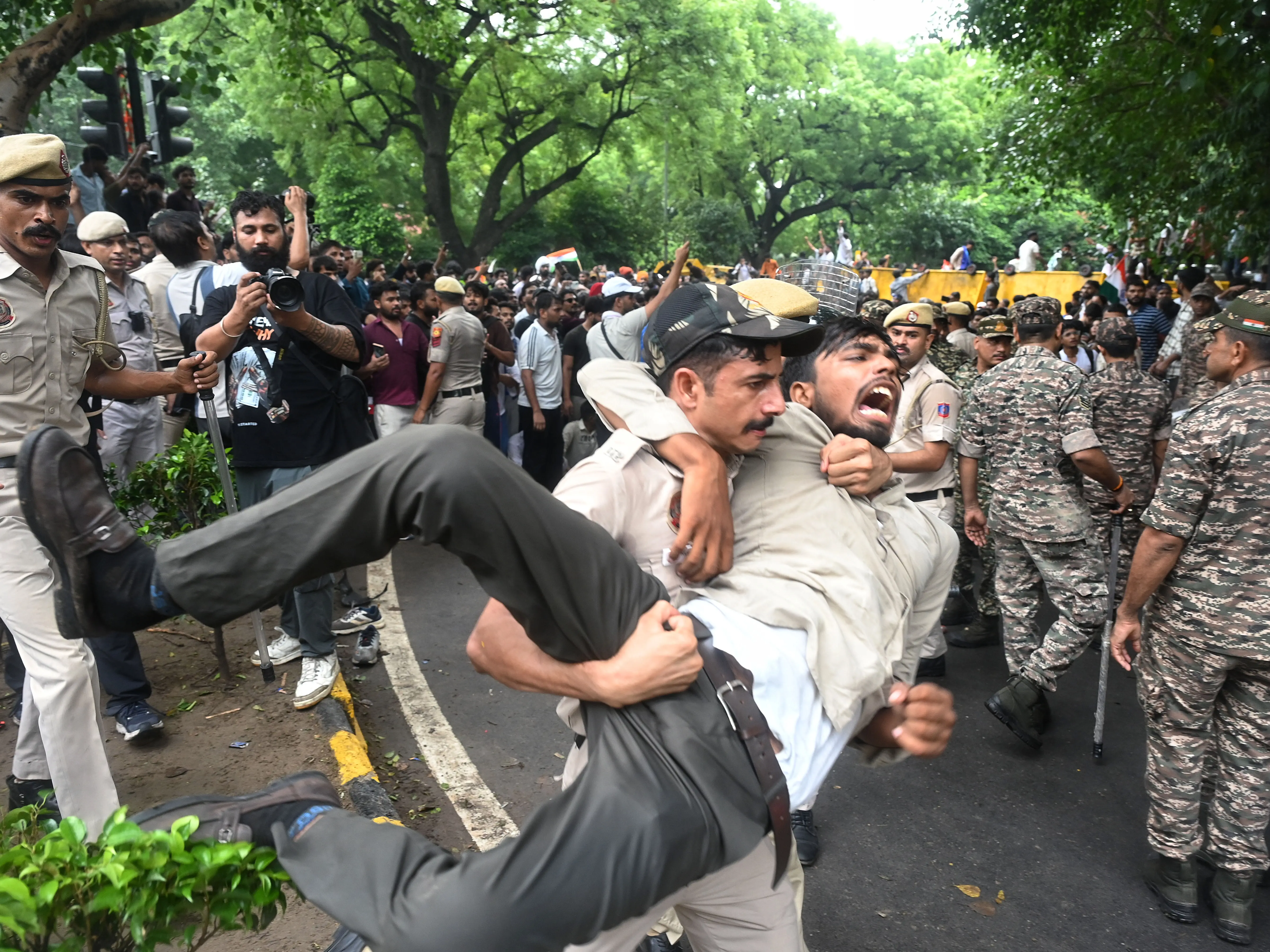)
NEET Protests riddled with misinformation? Delhi Police blocks 480 Pakistan-based handles spreading 'fake news' since Operation Sindoor
)
Dharmendra Pradhan resignation: Expert explains BJP's next move & CJP protest impact
&im=FitAndFill=(700,400))
Finished Kay Kay Menon's Adarsh Baal Vidyalaya? Here are 5 binge-worthy Hindi OTT series to stream next
)
Reacher star Alan Ritchson slams US President Donald Trump over Epstein files; White House fires back
)
Trump says Iranian school bombing photos could be AI-generated - 'I don’t think...'
)
Did the government avert a larger agitation by conceding to CJP's demands? WION Decodes
&im=FitAndFill=(700,400))
Why the S-400 fires its missiles straight up into the air
)
Google ends Play Services Support, likely to stop these Android phones from downloading apps & games
)
Another education minister resigned amid corruption row before Dharmendra Pradhan — but not in India
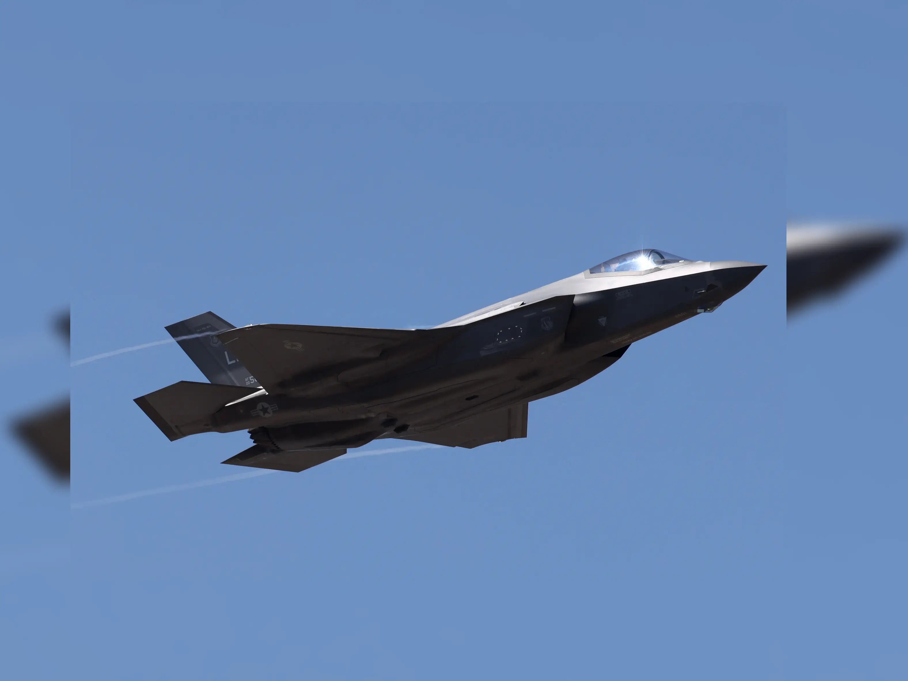)
US says Turkey still barred from F-35 program until it gives up Russian S-400 system: Report
)
Van rams into crowd at Berlin Pride event, one dead; suspect 'linked to Islamist circles'
)
'Vox Populi': Kamal Haasan, Chinmayi, Pa Ranjith react to Dharmendra Pradhan's resignation
&im=FitAndFill=(700,400))
Why US fighter jets use seamless bubble canopies compared to Russian jets
)
Russia-Ukraine war: Russia activates nuclear beast Admiral Nakhimov amid war
Ladakh region has been battling cold wave conditions as well. The Leh town recorded a minimum temperature of minus 11.7 degrees. While Kargil was at minus 14.3 degrees. Dras was at minus 22.5 degrees while the coldest place in North India still remains Zojila at minus 24 degrees.
Also Read: Maha Kumbh Mela 2025: NASA astronaut shares breathtaking PICS of 'well lit' Kumbh from space station
The MeT Department of Kashmir Valley has predicted La Nina effect which means cooler than average sea surface temperatures across central and eastern Pacific. This weather change mostly impacts the wind circulation patterns leading to more rains and snow. The MeT department has predicted that the winter period will prolong and will be very harsh in terms of temperature as well as rain and snow.
Meanwhile, for the next 24 hours the Met department has predicted clear skies and further dip in temperature. The weather will be dry till January 29 and thereafter until January 31, there are chances of snow across various parts of the region.