United States landmass suddenly expanded by 1 million square kilometres in size. Here's why

Map of the United States.
The landmass of the United States saw a sudden expansion by 1 million square kilometres (more than 386,000 square miles), which is more than twice the area of Spain.
This expansion in land was not because ofstrange geological forces or the invasion of a foreign land but because the country had made attempts to lay claim over its surrounding ocean-floor territory.
Continental shelves cover the areas of the seabed around huge landmasses where the sea is comparatively shallow in comparison with the open ocean.

As per international law, the countries are free to claim these continental shelves through which they are able to manage andexploit their resources.
Nearly 75 countries have defined their Extended Continental Shelf (ECS) limits, which refers to the continental shelf's portion beyond 200 nautical miles (230 miles) from the coast. Till last year, the United States had not defined its ECS.
New geographic coordinates were announced by the US State Department on December 19, 2023, which they claimed was their ECS area.
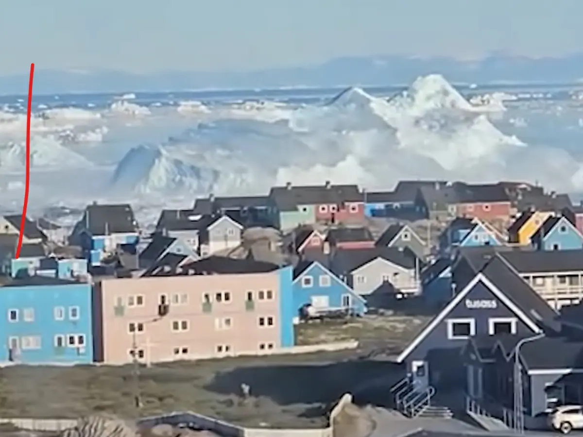)
Giant iceberg flips violently near Greenland exposing its underside - 'I didn't know they could do that'
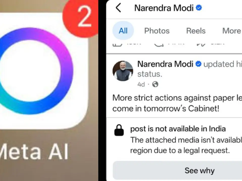)
'Spreading deepfakes, deleted PM Modi's video': Why Meta AI should be banned in India for interfering in Indian economy and democracy
)
‘Kill Melania, Barron’: Why is IRGC-linked media outlet urging ‘freedom fighters’ to assassinate Trump’s family? WATCH
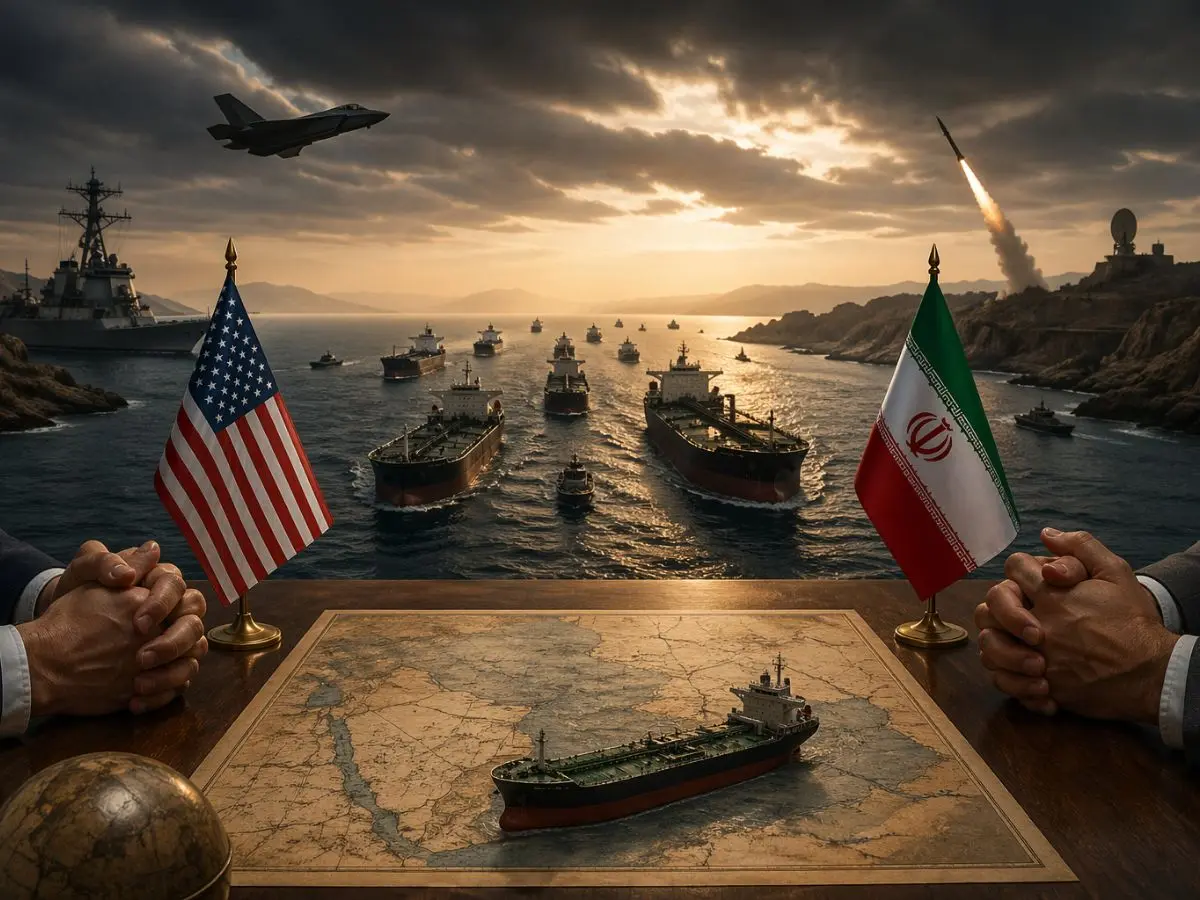)
'Islamic Republic will never make a deal with the US': Iran deputy speaker echoes Araghchi’s remark
)
NEET aspirant ends her life in Maharashtra after falling 11 marks short of cut-off
)
China deploying advanced fighter jets closer to India's northern frontier
)
Who will benefit from Kapil Sibal's ₹1 crore legal aid fund for NEET protesters? This is what we know
)
He predicted COVID-19 and 2008 economic crisis, was labeled fearmonger. Now he has another dire warning
)
India avoids higher US tariff, secures lower 10% rate. Here's how
)
Woman used AI to tell court what happened the night her ex-boyfriend 'raped' her. It was a bad idea
)
Rahul Gandhi slams BJP for felicitating Dharmendra Pradhan in Parliament, accuses Modi government of 'celebrating ruined futures'
)
'First dumb AI': Meta AI blocks Indian PM Modi's video in his own country, allows abuse ads and deletes livelihoods without explanation
)
Over 70% of Indian suicides abroad occur in Gulf countries, MEA data shows
)
3,000 years ago, humanity spoke thousands of languages — then fell silent. Where did they all go?
)
Tom Cruise's daughter Suri drops his surname; adopts Katie Holmes' middle name Noelle
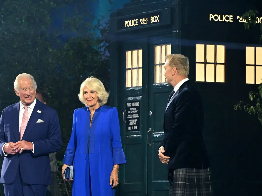)
The Royals enter the Doctor Who universe: King Charles and Queen Camilla beam into Commonwealth Games in TARDIS
)
'Broader struggle for democracy...': Greta Thunberg joins Indian students protest in London - What she said
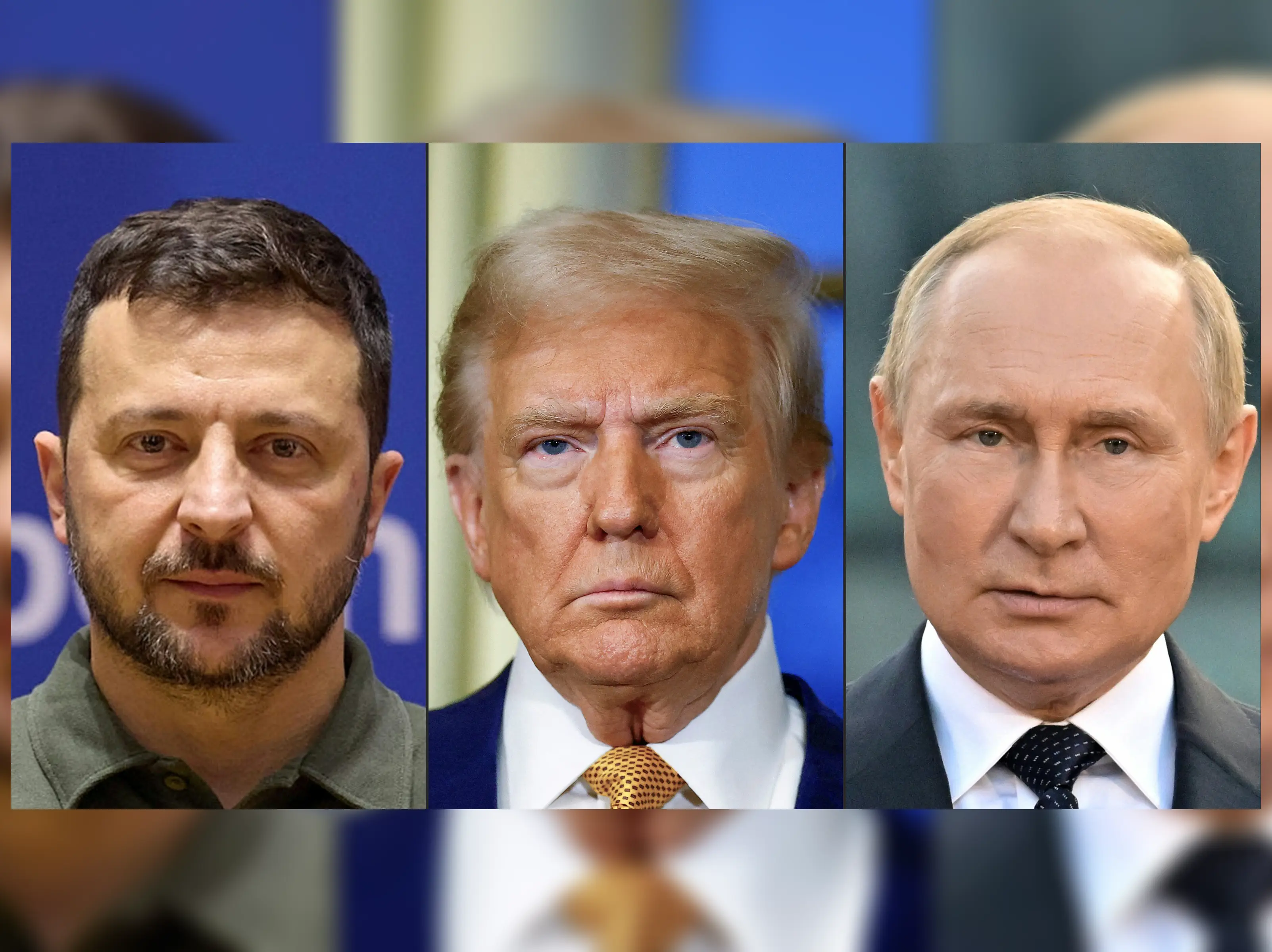)
'Very unimpactful': Trump downplays Russian support for Iran, promises to 'ask Putin' about Zelensky's claims
)
Pakistan-occupied Kashmir election turns violent: 19 killed, protests intensify as rigging allegations fly
)
Delhi Police issues BIG statement on viral 'don't leave national capital without permission' notice | FACT CHECK
)
Assam floods: Over 4.45 lakh affected across six districts; 631 villages inundated, Charaideo worst-hit
)
Russia-Ukraine War: Russia drops 3-tonne Glide bombs on Ukraine
)
Asim Munir eyes defence deal with Qatar & Turkiye after Kuwait as Pakistan seeks investments | Gravitas
)
RSS backed Jantar Mantar student protest? Mohan Bhagwat's 'question authority' remark resurfaces
)
ChatGPT invoked God, told pastor not to worry about his symptoms. Then pulmonary embolism hit
)
Jennifer Lopez's ex-husband Ojani Noa claims he confronted Sean 'Diddy' Combs over alleged affair
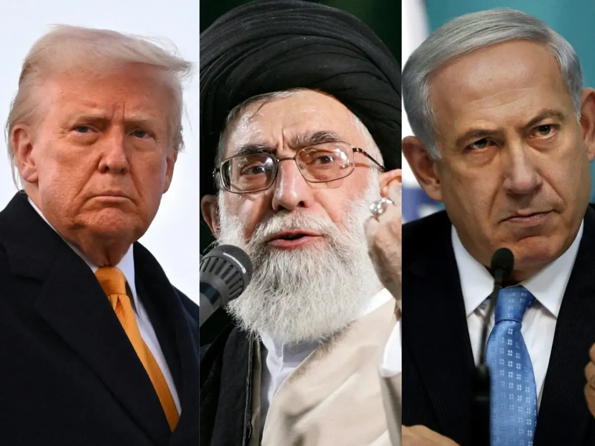)
Netanyahu to present Trump with fresh intel on Iran's SECRET 'Pickaxe Mountain' nuclear site: Report
)
Trump says Iranian school bombing photos could be AI-generated - 'I don’t think...'
)
NEET Protests riddled with misinformation? Delhi Police blocks 480 Pakistan-based handles spreading 'fake news' since Operation Sindoor
)
Sadie Sink's leaked Spider-Man: Brand New Day clip fuels fresh Jean Grey speculation
)
'Worst quality AI in market': Meta AI's moderation fail hits PM Modi and Indian Democracy
Also Read:US finalising 'take it or leave it' deal for Israel-Hamas war
The US authorities have collaborated with the US Geological Survey, NOAA and 12 other agencies to gather geological data for defining the outer limits of their ECS since 2003.
The United States has now claimed ECS in seven offshore areas like the Arctic, Atlantic (east coast), Bering Sea, Pacific (west coast), Mariana Islands, and two areas in the Gulf of Mexico.
The area claimed in total is 1 million square kilometres (more than 386,000 square miles) in size.
“America is larger than it was yesterday,” said Mead Treadwell, who is a former Alaska lieutenant governor and former chair of the US Arctic Research Commission, while speaking toAlaska Public Media.
“It’s not quite the Louisiana Purchase. It’s not quite the purchase of Alaska, but the new area of land and subsurface resources under the land controlled by the United States is two Californias larger,” Treadwell added.
How US define its ECS?
Explaining the process of making the definition official, Treadwell said that the US needs to submit reports and data to the United Nations Convention on Law of the Sea (UNCLOS).
However, the UNCLOS has not been ratified by the US because of complex political disagreements (the agreement has been ratified by 168 states and the European Union).
Watch:US-India deal allows access to vital defence resources, Indian officers at US Command Centres
Because of this, there is some uncertainty about how the proposition will be accepted as per the international law.
“If somebody came back and said, ‘Your science is bad,’ I think the United States would listen,” said Treadwell, while speaking to the media. “But I don’t think science is bad. I think we’ve had very good science," he added.
(With inputs from agencies)