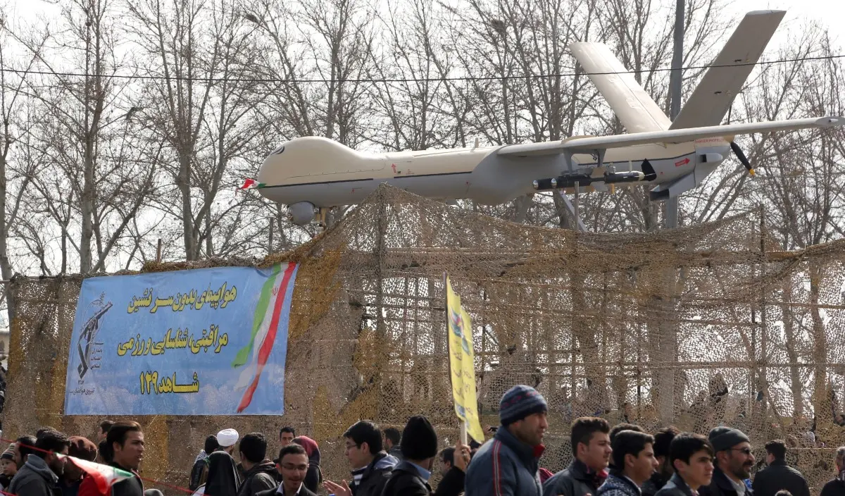
Which GPS technology does the Iranian Shahed-136 kamikaze drone use?
The Shahed-136 uses civilian GPS and GLONASS paired with 16-element CRPA antennas to resist jamming. It features RTK technology via cellular modems and an inertial navigation system for backup.

Uses 2,500km GPS GLONASS
The Shahed-136 relies on a hybrid satellite navigation system to strike targets at distances up to 2,500 kilometres. It primarily uses civilian-grade GPS and the Russian GLONASS network to guide its flight path. This dual-system approach allows the drone to navigate accurately across long distances without active human piloting.

16-Element Anti-Jamming CRPA
To counter electronic warfare, newer drone variants integrate a Controlled Reception Pattern Antenna. These specialised modules feature up to 16 individual elements designed to filter out external interference. By distinguishing genuine satellite signals from electronic jamming, the drone maintains its precise trajectory even in hostile airspace.

New L5 Frequency Support
Recent upgrades include the integration of new receiver modules to enhance positioning accuracy. These modern components support L1, L2, and L5 satellite frequencies, making the navigation system significantly harder to disrupt. Operating across multiple frequency bands provides a robust defence against standard military spoofing tactics.

RTK Network 3G Modems
Engineers have recently attached 3G and LTE mobile modems to the drone's navigation suite. This addition enables Real-Time Kinematic positioning, which uses internet-connected base stations to correct satellite location data instantly. The mobile network integration essentially turns local cellular infrastructure into a highly accurate navigation aid.
Backup Inertial Navigation 50kg
When satellite signals are completely jammed, the drone switches to an internal Inertial Navigation System. This backup mechanism uses a barometer to hold the current altitude and a compass to maintain the forward direction. The 50-kilogram payload continues its blind flight path until it escapes the jamming zone and reacquires GPS.

15 Spoofers Blocked Simultaneously
The advanced Kometa-M navigation module allows the drone to ignore multiple interference sources at once. Field data indicates the 16-element array can successfully block up to 15 different GPS spoofers simultaneously. This capability requires defending forces to deploy an exceptionally dense network of electronic warfare equipment.

100 Watts Defeats Signal
Despite robust anti-jamming hardware, the drone's navigation can still fail against raw signal power. A targeted electronic warfare source projecting 100 watts directly at the aircraft can overwhelm the antenna filters. This high-power approach blinds the satellite receiver, causing the delta-wing drone to lose stability and crash.
)
)
)
)
)