What are 4 Chinese ships doing in Indian Ocean and why their movements are being closely watched
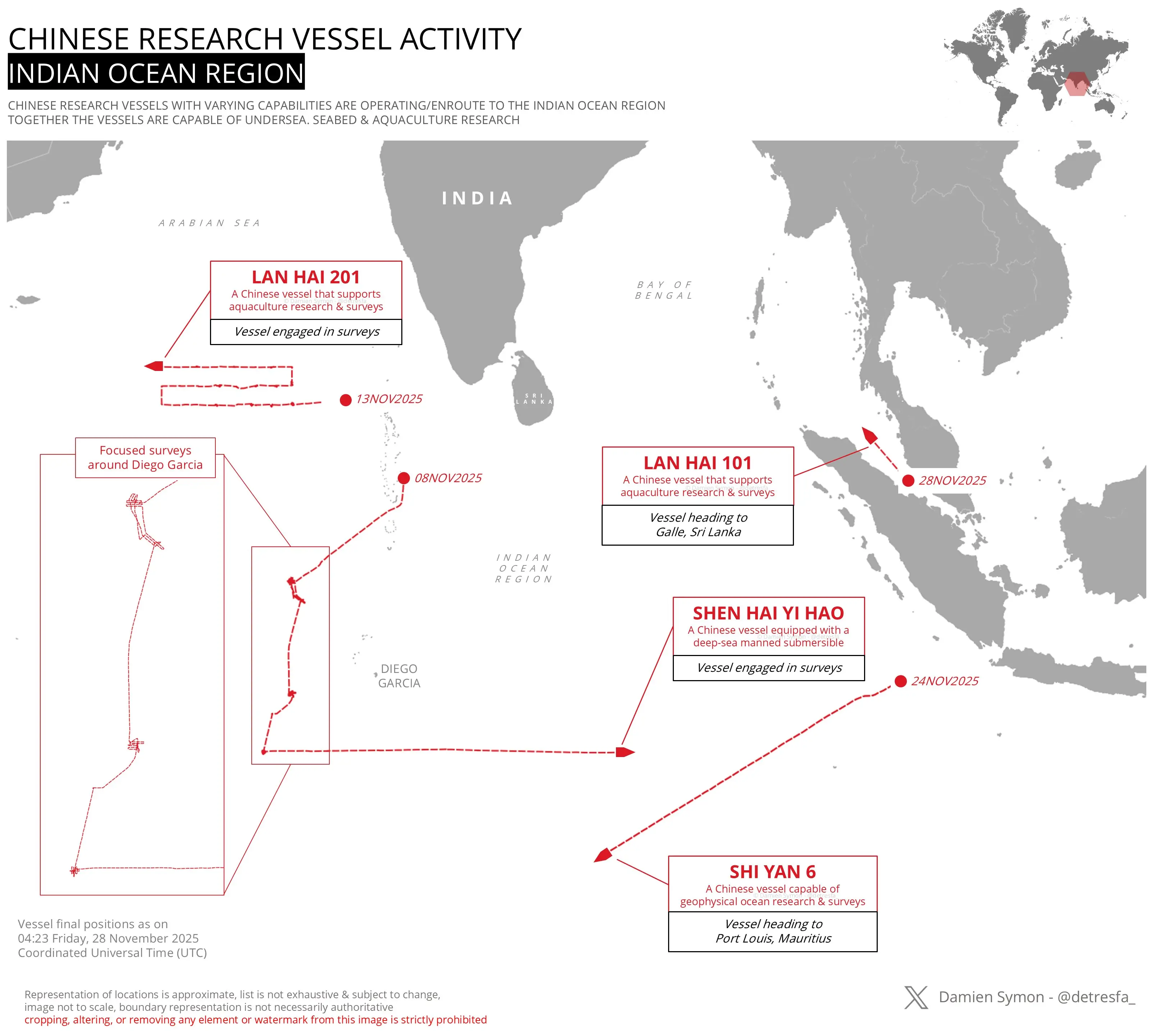
With vessels positioned near Sri Lanka, Diego Garcia, Mauritius, and Southeast Asian entry routes, China has a four-point presence in the Indian Ocean Region.

1. Four Chinese Research Ships Are Active Across the Indian Ocean Right Now
Satellite and AIS-based tracking shows four Chinese research vessels, Lan Hai 201, Lan Hai 101, Shen Hai Yi Hao and Shi Yan 6, operating across the Indian Ocean as of late November 2025. While officially classified as scientific ships, their advanced sensors, sonar equipment, and submersible platforms make their movements strategically sensitive, prompting monitoring by India and Western navies.
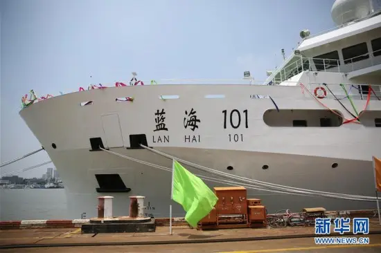
3. Lan Hai 101 Is Heading Toward Sri Lanka’s Galle Port
Lan Hai 101 was last tracked on 28 November 2025 heading toward Galle, Sri Lanka. Sri Lanka frequently allows Chinese research ships to dock for “replenishment,” but India views such stops with caution, given the sensitive oceanographic equipment onboard. The ship’s arrival near India’s southern flank adds to New Delhi’s maritime surveillance workload.
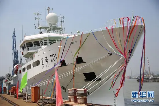
2. Lan Hai 201 Is Conducting Focused Surveys Near Diego Garcia
Lan Hai 201, a vessel that supports aquaculture and seabed research, has been carrying out repeated survey patterns near Diego Garcia, a crucial US military base used by India’s strategic partners. Its grid-like movement and prolonged presence suggest detailed seabed mapping, which can have both scientific and potential dual-use naval applications, including submarine-route planning.
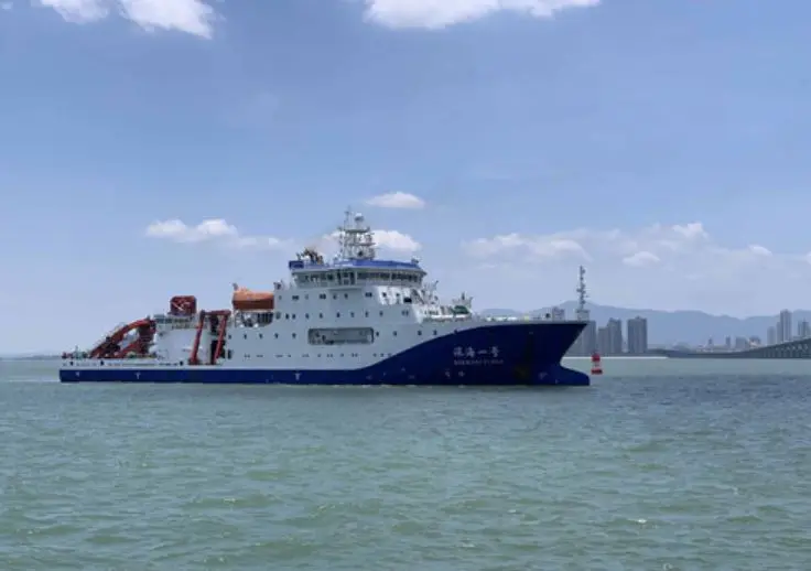
4. Shen Hai Yi Hao Is Operating West of Indonesia With a Deep-Sea Submersible
Shen Hai Yi Hao carries a manned deep-sea submersible, making it one of China’s more advanced research assets. On 24 November 2025, it was engaged in survey activity west of Indonesia, but its trajectory points toward the central Indian Ocean. A deep-sea submersible allows high-precision seabed sampling and underwater inspection, capabilities that overlap with submarine-support research.
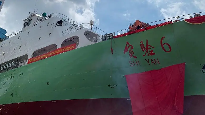
5. Shi Yan 6 Is Moving Toward Mauritius for Geophysical Surveys
Shi Yan 6, capable of geophysical and oceanographic surveys, was moving toward Port Louis, Mauritius. China often uses ships like Shi Yan 6 to map magnetic, seismic, and underwater acoustic signatures. These datasets can support marine science but can also be valuable for anti-submarine warfare (ASW) modelling and future naval deployments.

6. None of These Ships Are Naval Combatants, but India Views Them as “Strategically Sensitive”
Although these are not PLAN (Chinese Navy) warships, India and its partners classify such vessels as “dual-use platforms.” Seabed mapping, salinity profiles, temperature layers, and ocean-current measurements are crucial inputs for submarine navigation and missile-tracking algorithms. This is why India tracks them as carefully as it would military assets.
7. Their Combined Presence Effectively Encircles the Northern, Central and Western Indian Ocean
With vessels positioned near Sri Lanka, Diego Garcia, Mauritius, and Southeast Asian entry routes, China has a four-point presence in the Indian Ocean Region. Individually, these are research missions; collectively, they create a broad oceanographic intelligence footprint around India’s maritime neighbourhood, raising questions about China’s long-term strategic intentions in a region India considers vital to its security.
)
)
)
)
)