Satellite images reveal scale of Venezuela earthquake devastation; nearly 59,000 buildings damaged - NASA releases data

Satellite imagery released by NASA has revealed the staggering scale of destruction caused by Venezuela's twin earthquakes. Using radar data from the European Space Agency's Sentinel-1 satellite, researchers estimate that approximately 58,870 buildings were damaged or destroyed. Pics below.
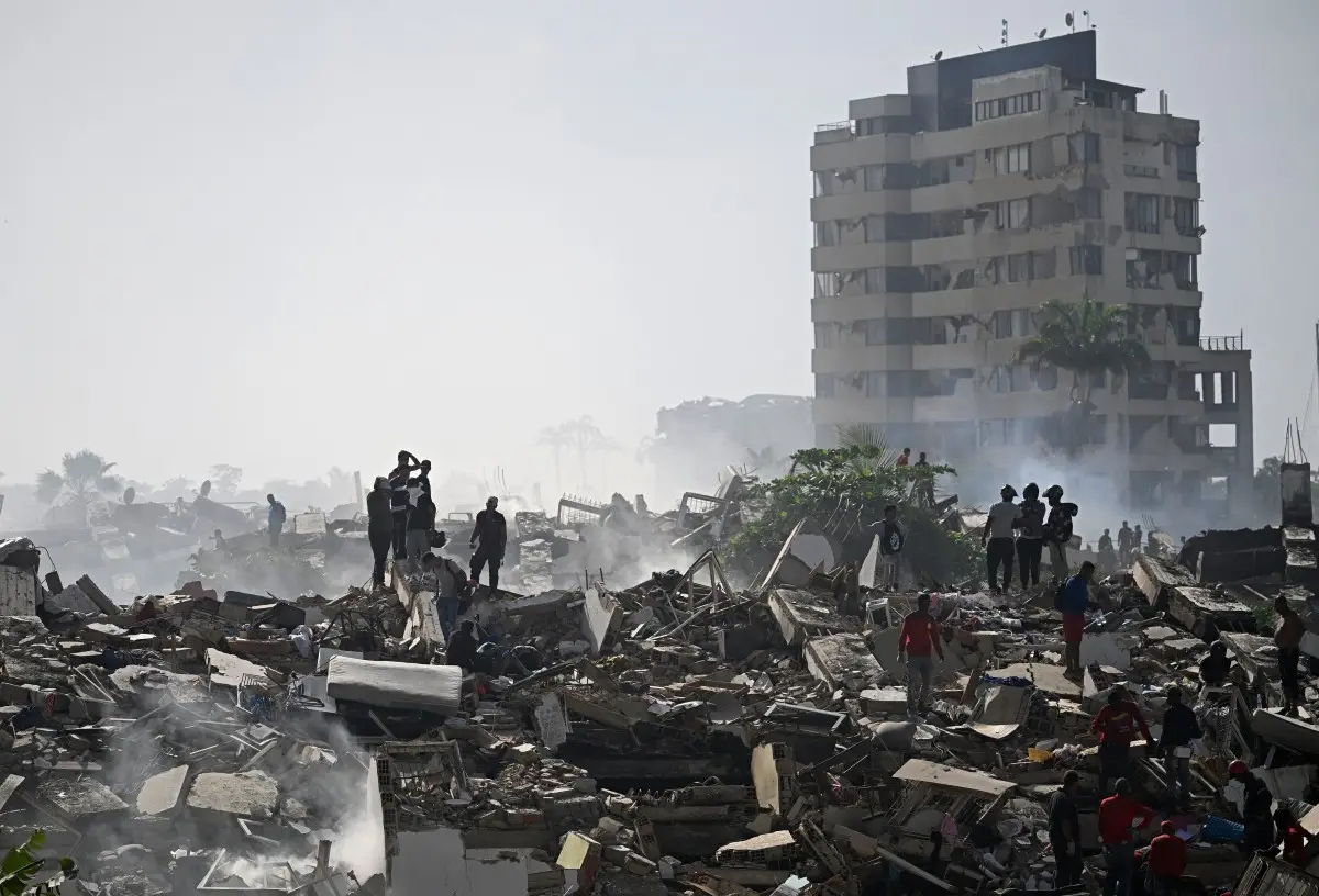
Venezuela earthquakes: Trail of destruction
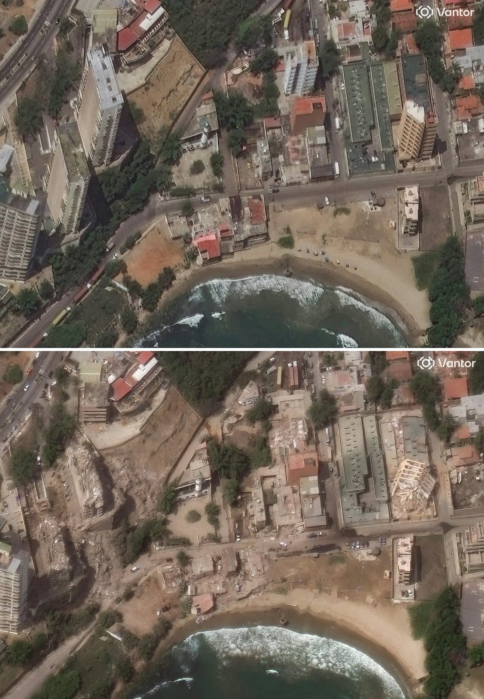
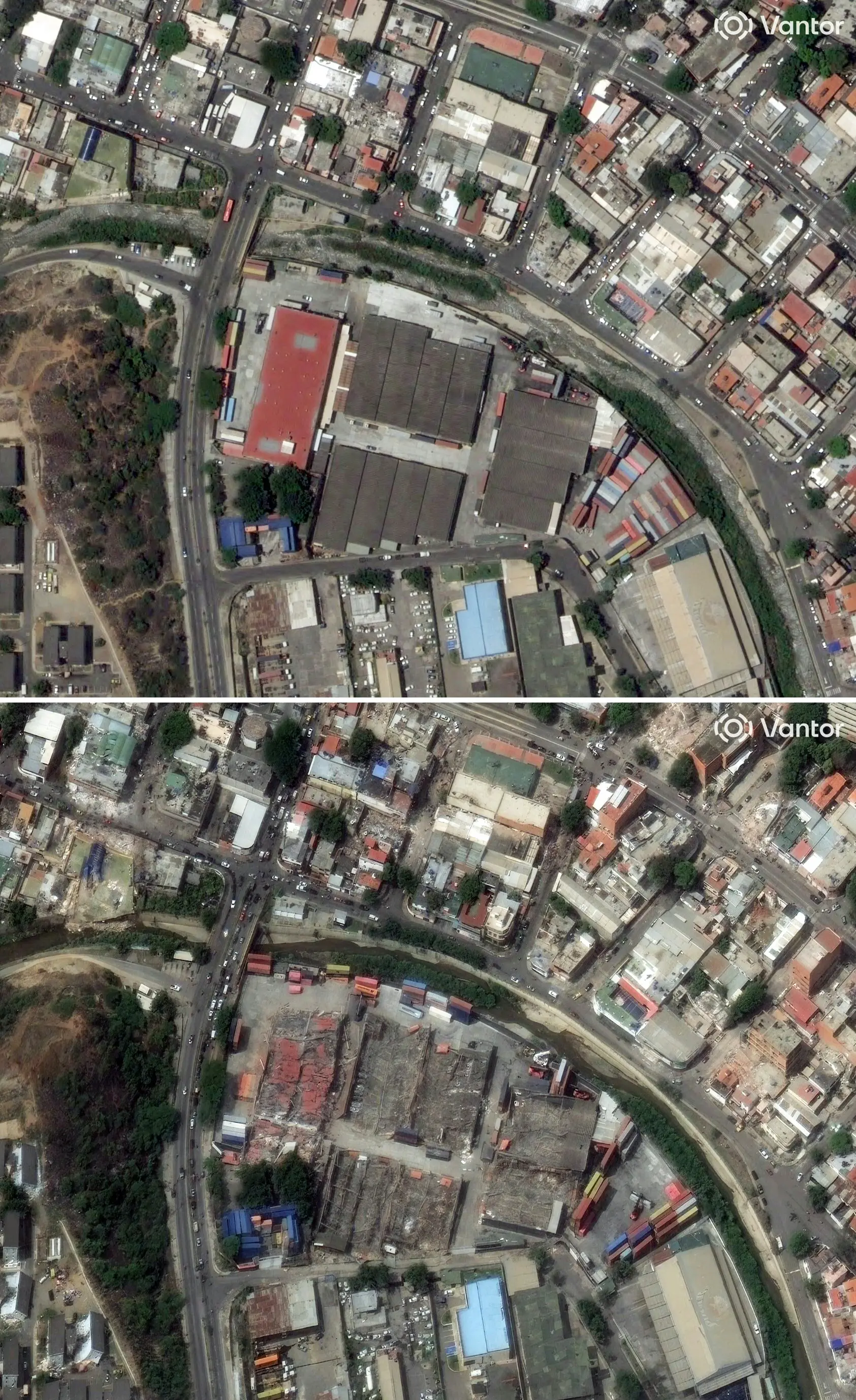
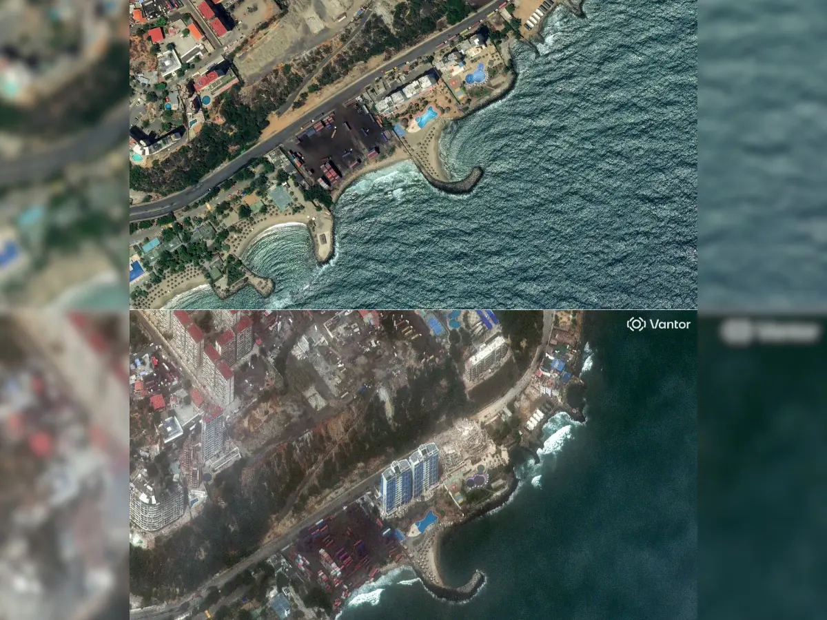
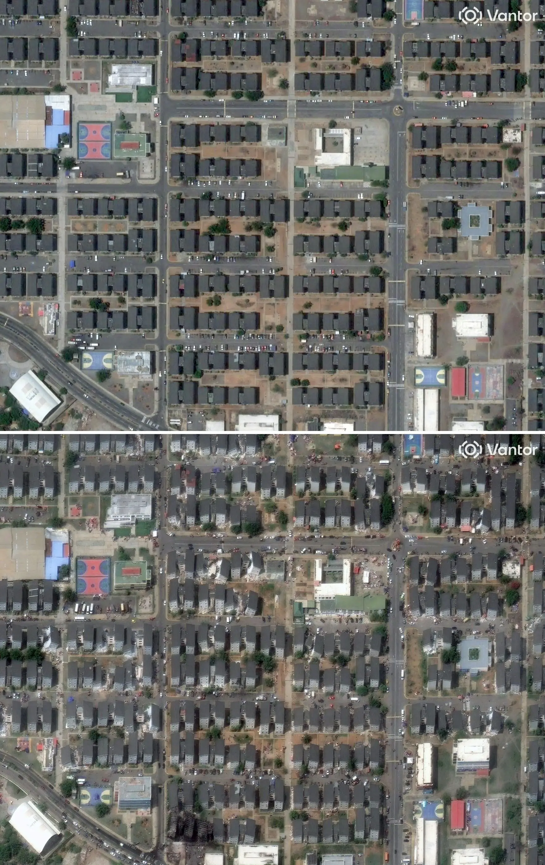
The trail of destruction left by last week's twin earthquakes in Venezuela is so massive that it is now clearly visible from orbit. A preliminary satellite analysis released by NASA and researchers at Oregon State University indicates that tens of thousands of structures have been damaged or entirely levelled across the disaster zone.
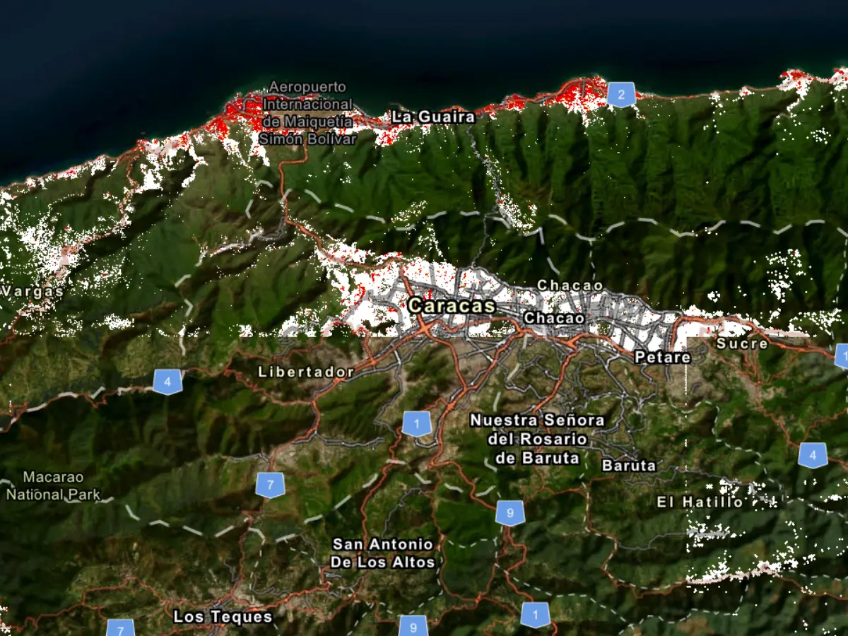
Nearly 59,000 buildings damaged
According to satellite data released by US space agency NASA, the twin earthquakes that struck Venezuela last week damaged or destroyed roughly 58,870 buildings. The shocking radar data was captured by the European Space Agency's Sentinel-1 satellite just 24 hours after the disaster.
"Approximately 58,870 buildings were likely damaged or destroyed across the affected region" based on satellite radar data gathered on June 25, the day after the earthquakes, according to researchers Corey Scher and Jamon Van Den Hoek of Oregon State University.
The data provides the first comprehensive look at the geometric scale of the crisis. While these orbital assessments are preliminary and await comprehensive ground verification, they offer emergency teams the clearest picture yet of the disaster's footprint.
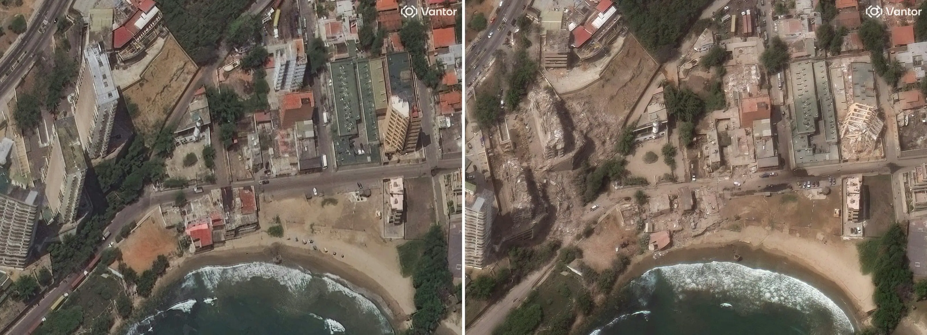
Strongest tremors in a century
The devastation was triggered by back-to-back earthquakes measuring magnitudes 7.2 and 7.5, striking less than a minute apart. The twin tremors tore through Venezuela's northern coast, completely destabilizing local infrastructure.
Official hospital logs place the confirmed death toll above 1,700, though local authorities fear the actual number will climb significantly as search teams reach isolated communities. At least 5,000 are injured and thousands of people remain missing.
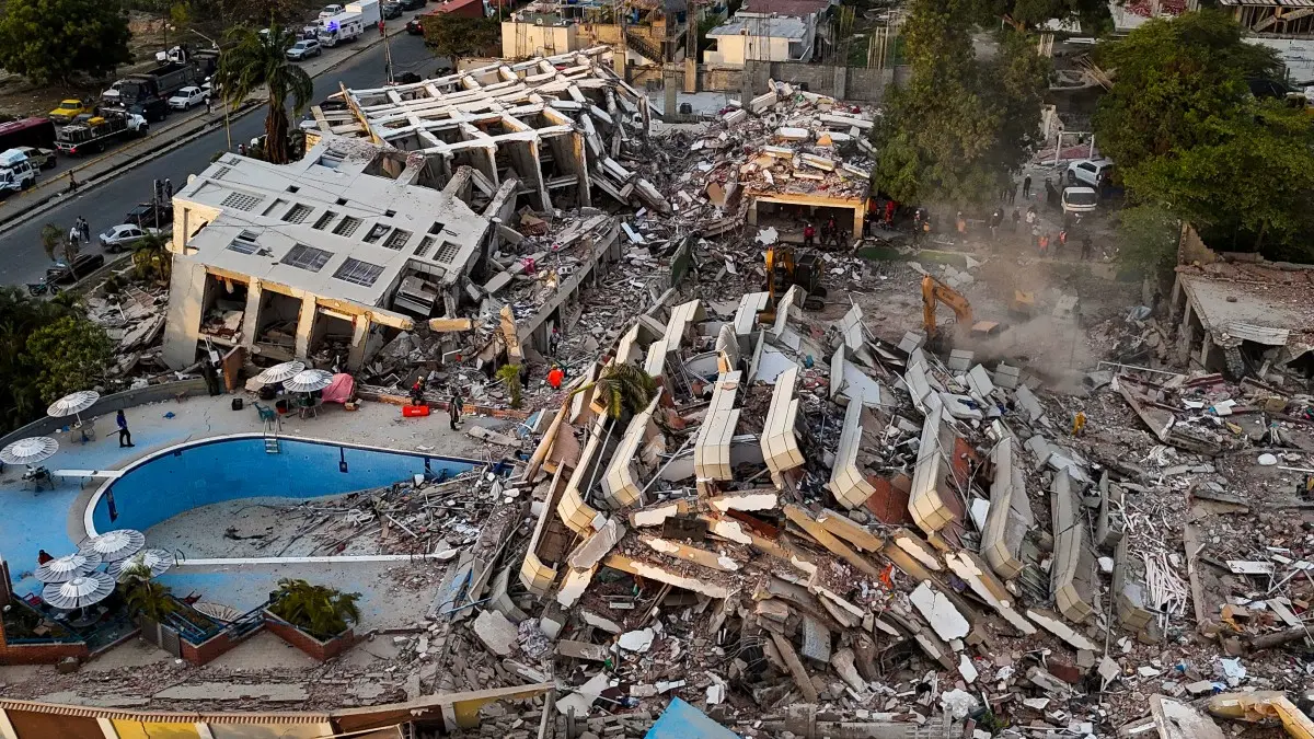
Neighbourhoods reduced to rubble
The satellite imagery shows severe surface alterations across major urban zones, consistent with pancake collapses (where floors of a multistorey building collapse vertically to stack on top of each other) and catastrophic structural failure.
Visuals from Venezuela show that on the ground, emergency workers and volunteers continue to deal with fields of broken concrete and twisted rebar. In the hardest-hit coastal areas, entire neighbourhoods have essentially been flattened into debris fields.
Orbiting sensors guide relief teams
NASA's disaster response teams have activated a network of satellites to assist local and international rescue operations. By feeding real-time geospatial data to personnel on the ground, the agency is helping map blocked transport routes, identify intact structures for staging areas, and target the most isolated pockets of survivors. The data is critical, as landslides and buckled roads have cut off multiple coastal towns.
NASA said that its satellites were "providing critical support, capturing imagery and data to help teams on the ground assess impacts and guide response efforts."
Ports and runways slowly reopen
Even as recovery teams navigate the debris, efforts to restore vital logistics links are moving forward. The Port of La Guaira, a primary maritime artery for humanitarian aid, resumed limited operations on Monday (Jun 29) following emergency structural repairs assisted by US military logistics personnel. American teams are similarly working alongside Venezuelan operators to restore full functionality to Simon Bolivar International Airport near Caracas, which suffered extensive damage to its main terminal complexes.
Search for survivors enters a grim phase
Five days after the initial shockwaves, the likelihood of finding live survivors is dropping rapidly. The critical 72-hour rescue window closed Saturday at 6:04 pm, shifting the focus toward long-term recovery.
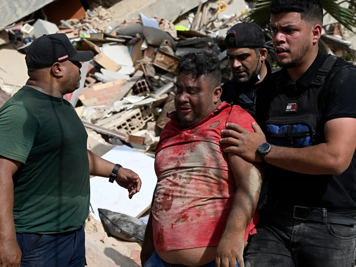
Despite the odds, localised successes are keeping rescue spirits alive. On Monday, teams successfully pulled a 21-year-old man from the wreckage of a collapsed building in the coastal town of Tanaguarena, proving that pockets of survival still exist within the ruins.
A massive humanitarian challenge
The United Nations estimates that up to seven million people live within the heavily affected impact zone, many of whom are now without reliable access to clean water, power, or medical care.
International aid has intensified, with 37 distinct search-and-rescue teams from 27 countries operating on the ground. Over 2,000 specialist personnel and 160 canine units are currently deployed, even as local infrastructure struggles to process the scale of the casualties.
Long-term economic fallout
Beyond the immediate humanitarian emergency, economists warn that the disaster will severely damage Venezuela's fragile economy. Initial UN estimates project baseline economic losses at USD 6.7 billion—roughly 6 per cent of the country's total GDP.
)
)
)
)
)