'Bihar, Bengal and more': History of 'Greater Bangladesh' map, that Sharif Osman Hadi posted before his death

In April-May 1947, barely months before Partition, Bengali leaders Huseyn Shaheed Suhrawardy (Premier of Bengal) and Sarat Chandra Bose (Congress leader) officially proposed a "Sovereign Socialist Republic of Bengal."

The Map That Triggered the Storm
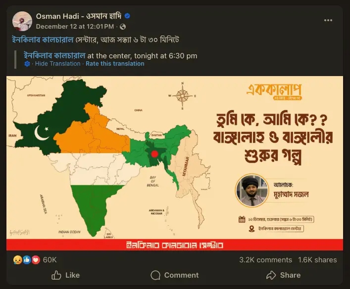
On December 12, 2025, Sharif Osman Hadi posted an image titled "The Natural Borders of Bengal." It was not a standard map of Bangladesh. It depicted a massive sovereign entity painted in green that swallowed:
- West Bengal (including Kolkata).
- The "Seven Sisters" (Assam, Meghalaya, Tripura, Mizoram, Manipur, Nagaland, Arunachal Pradesh).
- Bihar and Jharkhand (parts of historical Bengal Presidency).
- Arakan (Rakhine State) from Myanmar.
Simultaneously, the map showed Kashmir and Punjab fully merged into Pakistan, visually suggesting the complete disintegration of India.
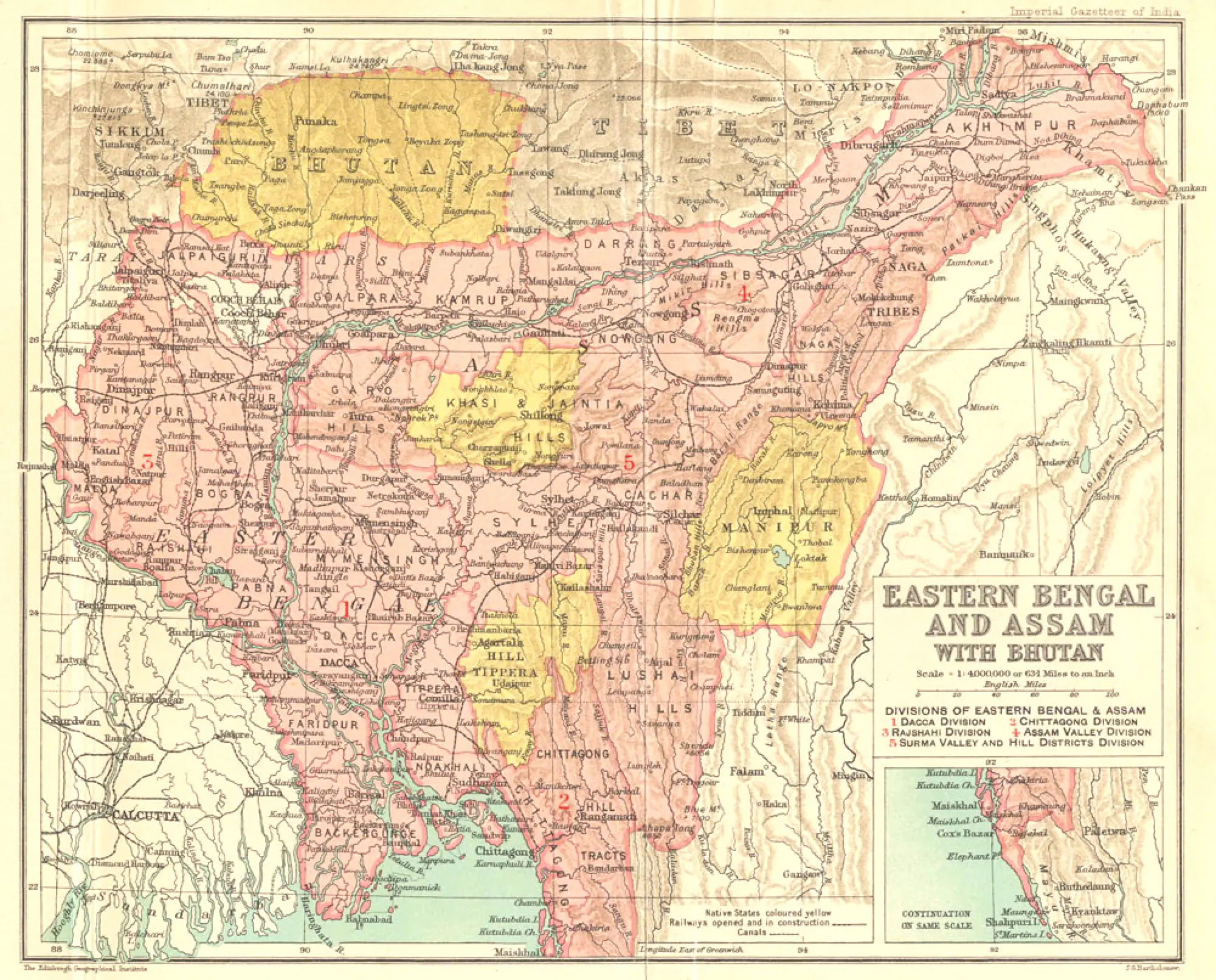
The 1905 Precedent: Curzon’s 'Eastern Bengal and Assam'
The idea of a unified Bengal isn't new; it dates back to the chaotic months before the Partition of 1905. The first time this specific geography appeared as an administrative reality was in 1905, during the First Partition of Bengal by Viceroy Lord Curzon. The British created a new province called "Eastern Bengal and Assam," with Dhaka as its capital. This merged the territories of modern-day Bangladesh with the entire Northeast of India. Though annulled in 1911 due to protests, this map remains the historical prototype for the "Greater Bangladesh" concept.
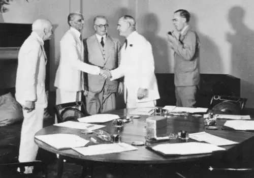
The 1946 Cabinet Mission Plan: 'Group C' Before Partition, the British Cabinet Mission Plan (1946) proposed a three-t
Before Partition, the British Cabinet Mission Plan (1946) proposed a three-tiered federation for India. Under this plan, Bengal and Assam were grouped together in 'Group C'. The Muslim League leadership accepted this because it created a Muslim-majority zone that included the resource-rich Northeast. The plan eventually collapsed due to Congress's opposition to mandatory grouping, leading to the Partition we know today.
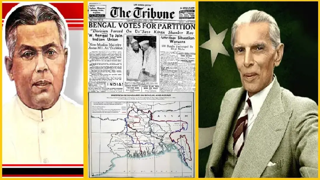
The 1947 Proposal: The 'United Bengal' Pact
In April-May 1947, barely months before Partition, Bengali leaders Huseyn Shaheed Suhrawardy (Premier of Bengal) and Sarat Chandra Bose (Congress leader) officially proposed a "Sovereign Socialist Republic of Bengal." The proposal envisioned a united Bengal separate from both India and Pakistan. While it didn't explicitly claim the entire Northeast, it laid the intellectual foundation for a Bengali nation distinct from the "Two-Nation Theory." It was rejected by the Congress High Command and the Hindu Mahasabha.
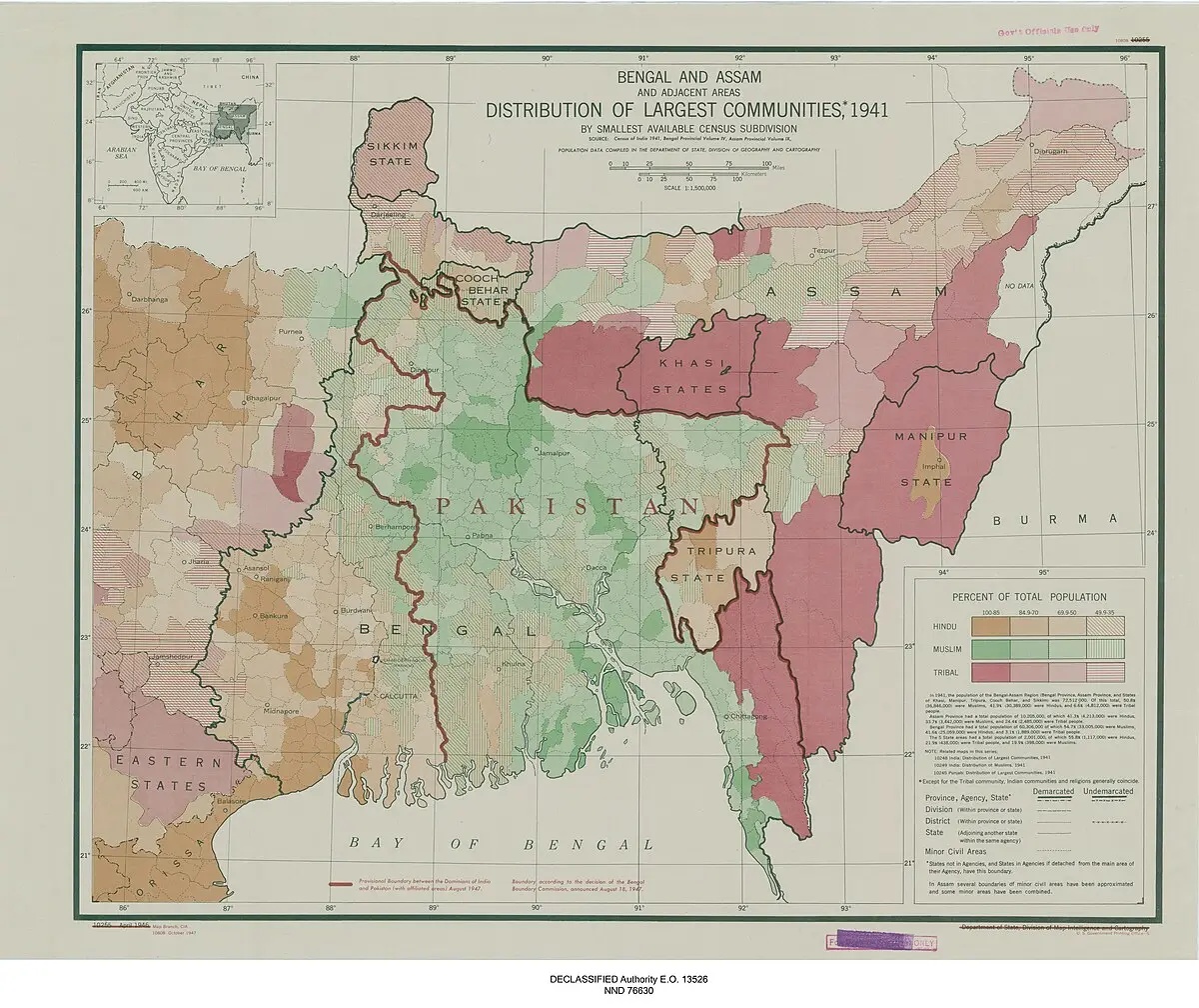
4. The 1947 Sylhet Referendum
The "Greater Bangladesh" map often claims parts of Assam. This is rooted in the July 1947 Sylhet Referendum, where the Sylhet district of Assam voted to join East Bengal (Pakistan). However, the Radcliffe Line (the border commission) only awarded the Muslim-majority Sylhet district to East Pakistan, leaving the rest of Assam (including the Bengali-speaking Barak Valley) in India. Radical maps often depict this "unfinished agenda" by coloring all of Assam green.
The 1991 'Lebensraum' Article
The modern demographic argument comes from a documented article. In October 1991, Bangladeshi intellectual Sadeq Khan wrote a piece titled "The Question of Lebensraum" in the Holiday weekly. In it, he argued that Bangladesh faces a population explosion and may eventually need "living space" (Lebensraum) in the adjacent Indian states. He wrote, "The natural trend of population overflow... is towards the sparsely populated lands of the South East (Arakan) and the North East (Seven Sisters)."
The Strategic Reality: The Siliguri Corridor
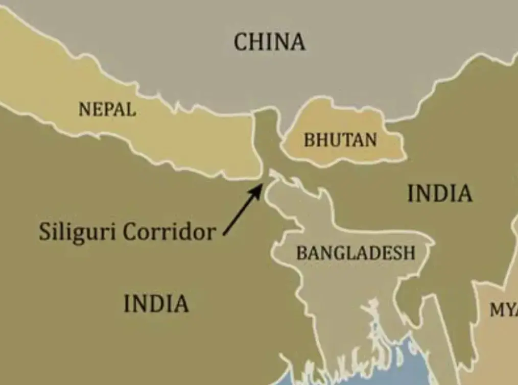
The map derives its potency from a geographical fact: the Siliguri Corridor (Chicken’s Neck). This 22-km wide strip is the only rail/road link connecting mainland India to its Northeast states. Military analysts (factually documented in Indian defense white papers) have long identified that any expansion of Bangladeshi territory northwards would sever this link. The map posted by Hadi visually depicted exactly this severance.
The 2025 Viral Post: 'The Natural Borders'
Finally, the map posted by Sharif Osman Hadi on December 12, 2025, combined these historical grievances into a single image. It was titled "The Natural Borders of Bengal" and went beyond historical proposals by simultaneously merging West Bengal, the Seven Sisters, and Arakan into Bangladesh, while showing Kashmir and Punjab in Pakistan. This post transformed historical debates into a direct challenge to current sovereign borders, leading to the tensions witnessed today.
)
)
)
)
)