Explained: How Sriharikota became an ideal location for being India's spaceport?

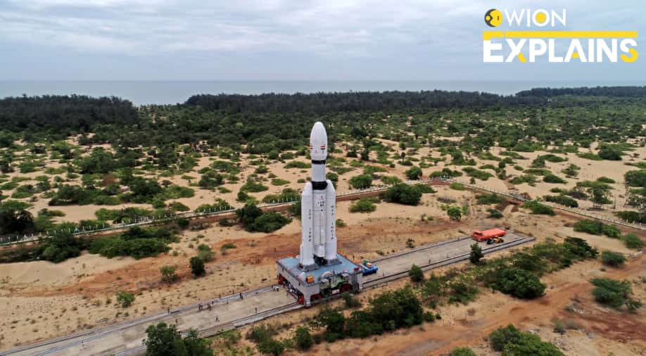
Sriharikota, ISRO's launch pad
Amid hopeful eyes and cheerful smiles, India’s third moon mission, Chandrayaan-3 was successfully launched on July 14. A mission that was started as an ambitious dream by scientists in India has now become a tangible reality that will soon transform into billion opportunities in future.
The Chandrayaan-3, took off at 2:35 pm IST on Friday via India’s heaviest rocket, Launch Vehicle Mark- III (LVM3), carrying a Rover and a Lander.
“Chandrayaan 3 is on its way to the moon,” ISRO chairman S Somanath said minutes after the satellite separated from the rocket after nearly 16 minutes of flight.
And as the rocket took the Chandrayaan-3 to its final stage, the elated mission director, Mohan Kumar said, “I am happy to inform that Chandrayaan 3 has been successfully injected in a precise orbit”.
These announcements of Chandryaan-3’s success were made by Indian Space Research Organisation (ISRO)’s spaceport, Satish Dhawan Space Centre (SDSC), which is located in Sriharikota, Andhra Pradesh. Present outside the SDSC, at the launch view gallery, was a crowd of rejoiced Indians awaiting the live launch of the historic lunar mission.
Previously also, the Chandrayaan-2 and many other ISRO’s crucial launches took place at this very site in Sriharikota. Sriharikota is not a very fancy city, but a small island off the Bay of Bengal coast.
Watch |Chandrayaan 3: India to attempt soft landing on lunar surface
This barrier island houses the SDSC, which is one of the two satellite launch centres in India. The other is the Thumba Equatorial Rocket Launching Station, in Thiruvananthapuram, Kerala. The SDSC became operational on 9 October 1971, when ‘Rohini-125’, a small-sounding rocket took off from the Sriharikota Range.
How Sriharkota became an ideal spot for ISRO’s launches?
The answer to this dates back to the year 1969, when Sriharikota was first chosen to launch a satellite. The island, which covers an area of approximately 43,360 acres with a 50 km coastline, had several factors that influenced its selection.
The hunt for a perfect location for India’s future launches was spearheaded by Vikram Sarabhai, the founder of the Indian space programme. He told his fellow scientist and a close associate Eknath Vasant Chitnis to look for a launch site on the eastern coast of the country.
In March 1968, Chitnis contacted the then Director of Industry of Andhra Pradesh, Abid Hussain, who helped him acquire information and prepare maps for potential sites, including Sriharikota.
Sriharikota was selected among potential sites for having proximity to the equator, which will provide extra centripetal force from the rotation of Earth.
According to the book, From Fishing Hamlet to Red Planet: India’s Space Journey, “By launching a rocket eastwards, one can take advantage of Earth’s rotation. For a launch site close to the equator the magnitude of the velocity imparted due to Earth’s rotation is about 450 m/s, which can lead to a substantial increase in the payload for a given launch vehicle. Geostationary satellites must necessarily be in the equatorial plane. So, for such satellites, the closer the launch site is to the equator the better it is”.

Apart from this, there were other reasons as well that made Sriharikota an ideal place for satellite launches.
Stable geographical platform
For a launch to take place successfully, the land should be solid enough to withstand the intense vibrations that are produced during a launch. With a strong soil composition ad hard rock beneath it, Sriharikota meets this requirement, as explained by Deviprasad Karnik, Director of Publication and Public Relations at ISRO, in a report by News Minute.
Not just this, many reports even suggest that Sriharikota is the second-best located spaceport in the world, after the Kennedy Space Centre in the United States.
Why the launch pad was named after Satish Dhawan?
Satish Dhawan was an Indian aerospace engineer, who was widely known as the father of experimental fluid dynamics research in India. He was the chairman of ISRO from 1972-84.

His efforts led to operational systems like INSAT, a telecommunications satellite; IRS, the Indian Remote Sensing satellite; and the PSLV which placed India in the league of space-faring nations.
What is SDSC-SHAR?
Satish Dhawan Space Centre (SDSC) or Sriharikota High Altitude Range (SHAR) is a launch site equipped with two launch pads. The centre has a separate launch pad for launching sounding rockets. It provides the necessary launch base infrastructure for sounding rockets of ISRO and for assembly, integration and launch of sounding rockets and payloads.
SHAR covers a total area of about 145 km square. Prior to its acquisition for ISRO by the Government of India, it was a firewood plantation of Eucalyptus and Casuarina trees. The island is affected by both south-westerly and north-easterly monsoons, but heavy rains come only in October and November. Thus many clear days are available for outdoor static tests and launching.
(With inputs from agencies)
WATCH WION LIVE HERE
You can now write for wionews.com and be a part of the community. Share your stories and opinions with us here.