NASA posts first images taken by Earth-observing spacecraft Landsat 9

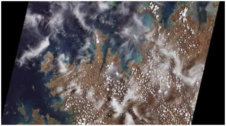
NASA on Sunday posted images captured by its Landsat 9 satellite. The satellite has taken its first light images of Earth. Landsat 9 is a joint mission between NASA and US Geological Survey (USGS). The mission was launched on September 27 this year.
The images that have been released have been captured on October 31. The images are likely to tell people how to better manage resources and make them realise effect climate change is having on Earth.
NASA administrator Bill Nelson said in a statement that Landsat programme “has the proven power to not only improve lives but also save lives"
"What a sight! #Landsat 9 captured its first images Oct. 31, and they’re striking! These data-rich images show us glaciers, actively burning fires and more, continuing a 50-year partnership between @NASA and @USGS. This image of the remote coastal islands and inlets of the Kimberley region of Western Australia was Landsat 9’s very first," says NASA in its Instagram post that depicts one of the photos taken by Landsat 9.
Landsat 9 has several improvements and has an edge over its predecessors Landsat 8 and Landsat 9
Landsat 9 has the capability to differentiate more than 16000 shades of given wavelength colour as opposed to Landsat 7 which can differentiate only 256 colours.